U.S. Geological Survey Data Series 445
| Item | Details | Trackline Map – UTM Zone 17 |
|---|---|---|
| Minimum Northing Minimum Latitude |
3148773.6 28° 27.8089' N |
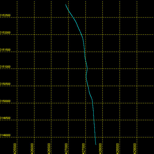 |
| Maximum Northing Maximum Latitude |
3152879.6 28° 30.0357' N |
|
| Minimum Easting Minimum Longitude |
426877.5 081° 44.8145' W |
|
| Maximum Easting Maximum Longitude |
427825.2 081° 44.2492' W |
|Back|

![]() U.S. Department of the Interior |
U.S. Geological Survey
U.S. Department of the Interior |
U.S. Geological Survey
URL: DVD/maps/linenav/08b10_nav.html
Page Contact Information: Feedback
Page Last Modified: May 12, 2009 11:30 EST
