U.S. Geological Survey Data Series 445
| Item | Details | Trackline Map – UTM Zone 17 |
|---|---|---|
| Minimum Northing Minimum Latitude |
3163646.9 28° 35.8422' N |
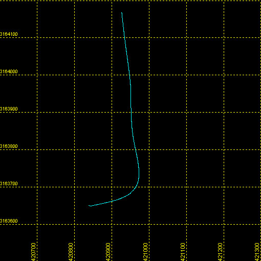 |
| Maximum Northing Maximum Latitude |
3164170.1 28° 36.1261' N |
|
| Minimum Easting Minimum Longitude |
420837.4 081° 48.5775' W |
|
| Maximum Easting Maximum Longitude |
420975.8 081° 48.4948' W |
|Back|

![]() U.S. Department of the Interior |
U.S. Geological Survey
U.S. Department of the Interior |
U.S. Geological Survey
URL: DVD/maps/linenav/08b22_nav.html
Page Contact Information: Feedback
Page Last Modified: May 12, 2009 11:30 EST
