U.S. Geological Survey Data Series 445
| Item | Details | Trackline Map – UTM Zone 17 |
|---|---|---|
| Minimum Northing Minimum Latitude |
3156276.6 28° 31.9436' N |
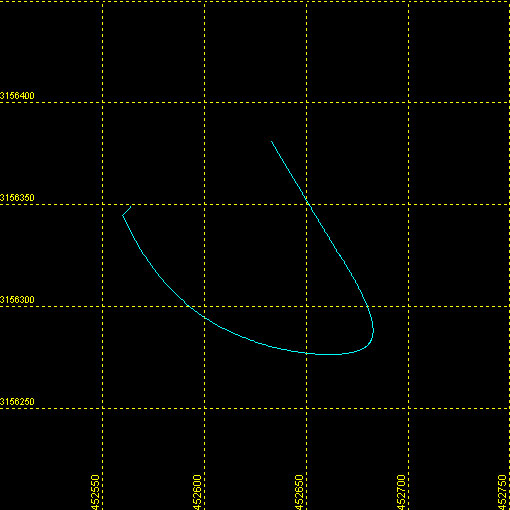 |
| Maximum Northing Maximum Latitude |
3156382.1 28° 32.0010' N |
|
| Minimum Easting Minimum Longitude |
452559.5 081° 29.0940' W |
|
| Maximum Easting Maximum Longitude |
452683.3 081° 29.0183' W |
|Back|

![]() U.S. Department of the Interior |
U.S. Geological Survey
U.S. Department of the Interior |
U.S. Geological Survey
URL: DVD/maps/linenav/08b45_nav.html
Page Contact Information: Feedback
Page Last Modified: May 12, 2009 11:30 EST
