Data Series 450
|
|
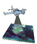
ATM Coastal Topography–Mississippi, 2001Amar Nayegandhi,1 Xan Yates,1 John C. Brock,2 A.H. Sallenger,3 Emily S. Klipp,1 and C. Wayne Wright3 1Jacobs Technology Inc., St. Petersburg, FL; 2U.S. Geological Survey, Coastal and Marine Geology Program, Reston, VA; 3U.S. Geological Survey, Florida Integrated Science Center, St. Petersburg, FL. This DVD contains lidar-derived first-surface (FS) topography GIS datasets of the Mississippi coastline, from Lakeshore to Petit Bois Island. These datasets were acquired September 9-10, 2001. Click on a blue tile to view the corresponding images and links to each data directory. Click on the red tile to view the 4-meter-resolution mosaic and link to the corresponding directory.
Suggested Citation: Nayegandhi, Amar, Yates, Xan, Brock, J.C., Sallenger, A.H., Klipp, E.S., and Wright, C.W., 2009, ATM Coastal Topography–Mississippi, 2001: U.S. Geological Survey Data Series 450, 1 DVD. Publications are available from USGS Information Services, Box 25286, Federal Center, Denver, CO 80225-0046 (telephone: 1-888-ASK-USGS; email: infoservices@usgs.gov). |

![]() U.S. Department of the
Interior | U.S. Geological Survey
U.S. Department of the
Interior | U.S. Geological Survey
URL: https://pubsdata.usgs.gov/pubs/ds/450/index.html
Page Contact Information: Feedback
Maintained by: Publishing Service Center
Page Last Modified: Monday, 28-Nov-2016 14:49:58 EST