Data Series 475
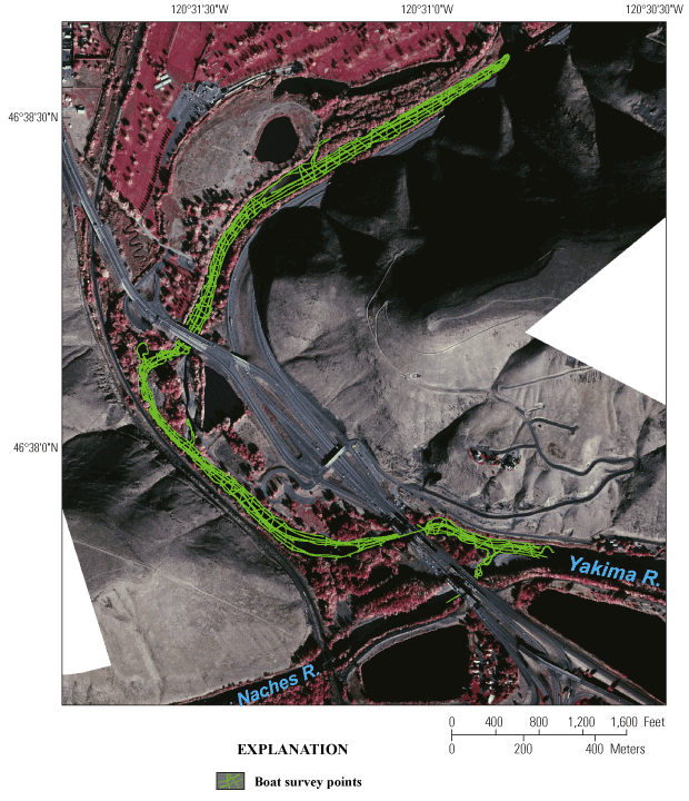
Figure 10. Boat survey points on the Naches and Yakima Rivers in and near the Selah Gap near Yakima, Washington, 2008. Background image is a color infrared photograph taken in 2000 and provided by the Bureau of Reclamation. |
For additional information contact: Part or all of this report is presented in Portable Document Format (PDF); the latest version of Adobe Reader or similar software is required to view it. Download the latest version of Adobe Reader, free of charge. |

![]() U.S. Department of the Interior | U.S. Geological Survey
U.S. Department of the Interior | U.S. Geological Survey
URL: http://
pubsdata.usgs.gov
/pubs/ds/475/figure10.html
Page Contact Information: Contact USGS
Page Last Modified:
Monday, 28-Nov-2016 14:57:52 EST
