Data Series 475
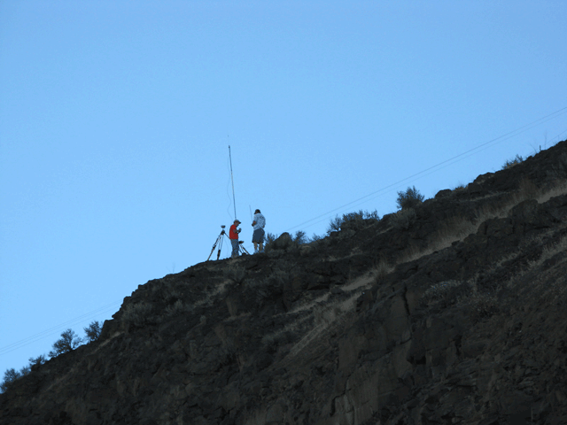
Figure 2. A base station, designation GP39082-23, on a rocky ledge in the Selah Gap near Yakima, Washington. Basic components of the base station shown are a global positioning system (GPS) receiver on a tripod and a radio on a separate tripod (right of the GPS receiver) with a radio transmitting antenna. The GPS controller that logs the data and sets the various parameters in the instruments is not shown. (Photograph taken by Karen Payne, U.S. Geological Survey, August 13, 2008) |
For additional information contact: Part or all of this report is presented in Portable Document Format (PDF); the latest version of Adobe Reader or similar software is required to view it. Download the latest version of Adobe Reader, free of charge. |

![]() U.S. Department of the Interior | U.S. Geological Survey
U.S. Department of the Interior | U.S. Geological Survey
URL: http://
pubsdata.usgs.gov
/pubs/ds/475/figure2.html
Page Contact Information: Contact USGS
Page Last Modified:
Monday, 28-Nov-2016 14:57:48 EST
