Data Series 475
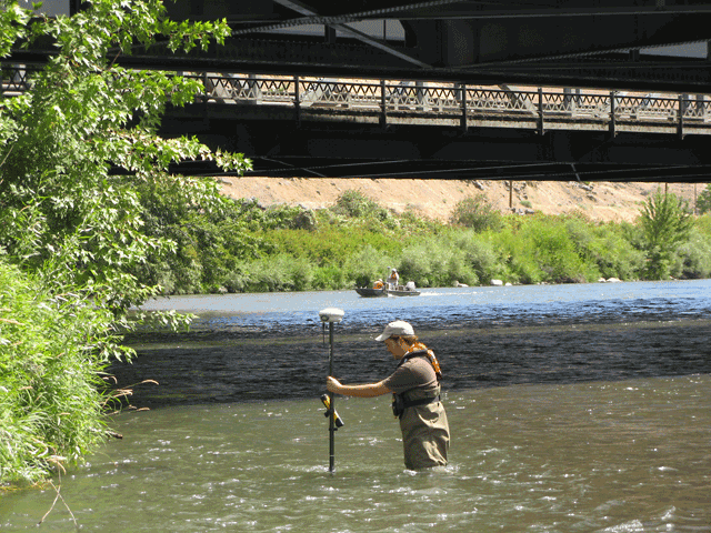
Figure 3. Collection of an elevation point using a hand-held global positioning system (GPS) device in shallow water near the confluence of the Naches and Yakima Rivers near Yakima, Washington, 2008. GPS receiver near technician in foreground is a white dome instrument on a 2-meter rod with the GPS controller attached about half-way up the rod. The boat crew in the background is traversing the river collecting data with a rover GPS and echo sounder. (Photograph taken by Karen Payne, U.S. Geological Survey, August 13, 2008.) |
For additional information contact: Part or all of this report is presented in Portable Document Format (PDF); the latest version of Adobe Reader or similar software is required to view it. Download the latest version of Adobe Reader, free of charge. |

![]() U.S. Department of the Interior | U.S. Geological Survey
U.S. Department of the Interior | U.S. Geological Survey
URL: http://
pubsdata.usgs.gov
/pubs/ds/475/figure3.html
Page Contact Information: Contact USGS
Page Last Modified:
Monday, 28-Nov-2016 14:57:48 EST
