Data Series 475
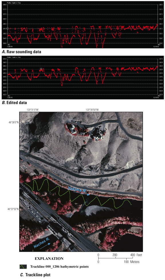
Figure 8. Echo-sounding data for ship track 000_1206 on the Yakima River near the confluence with the Naches River near Yakima, Washington, 2008. (A) Single-beam editor showing raw sounding data with time along the x-axis (12:06:18 to 12:18:36) and elevation in meters along the y-axis. (B) Single-beam editor showing edited data after deleting elevation points with the same axes (y-axis adjusted to show all lower data). (C) Trackline 000_1206 plotted over a color infrared image taken in 2000 and provided by the Bureau of Reclamation. |
For additional information contact: Part or all of this report is presented in Portable Document Format (PDF); the latest version of Adobe Reader or similar software is required to view it. Download the latest version of Adobe Reader, free of charge. |

![]() U.S. Department of the Interior | U.S. Geological Survey
U.S. Department of the Interior | U.S. Geological Survey
URL: http://
pubsdata.usgs.gov
/pubs/ds/475/figure8.html
Page Contact Information: Contact USGS
Page Last Modified:
Monday, 28-Nov-2016 14:57:51 EST
