Data Series 501
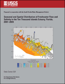
ABSTRACTThe watershed of the Ten Thousand Islands (TTI) estuary has been substantially altered through the construction of canals and roads for the Southern Golden Gate Estates (SGGE), Barron River Canal, and U.S. 41 (Tamiami Trail). Two restoration projects designed to improve freshwater delivery to the estuary are the Picayune Strand Restoration Project, which includes the Southern Golden Gate Estates, and the Tamiami Trail Culverts Project; both are part of the Comprehensive Everglades Restoration Plan. To address hydrologic information needs critical for monitoring the effects of these restoration projects, the U.S. Geological Survey initiated a study in October 2006 to characterize freshwater outflows from the rivers, internal circulation and mixing within the estuary, and surface-water exchange between the estuary and Gulf of Mexico. The effort is conducted in cooperation with the South Florida Water Management District and complemented by monitoring performed by the Rookery Bay National Estuarine Research Reserve. Surface salinity was measured during moving boat surveys using a flow-through system that operated at planing speeds averaging 20 miles per hour. The data were logged every 10 seconds by a data recorder that simultaneously logged location information from a Global Positioning System. The major rivers, bays, and nearshore Gulf of Mexico region of the TTI area were surveyed in approximately 5 hours by two boats traversing about 200 total miles. Salinity and coordinate data were processed using inverse distance weighted interpolation to create salinity contour maps of the entire TTI region. Ten maps were created from salinity surveys performed between May 2007 and May 2009 and illustrate the dry season, transitional, and wet season salinity patterns of the estuarine rivers, inner bays, mangrove islands, and Gulf of Mexico boundary. The effects of anthropogenic activities are indicated by exceptionally low salinities associated with point discharge into the estuary from the Faka Union Canal and Barron River during the wet season. Low salinities in Faka Union Bay may cause reduced diversity and density of submerged aquatic vegetation, fish, and benthic organisms compared with neighboring Fakahatchee Bay. The Faka Union Canal System reduced the size of the watershed for the western TTI estuary, resulting in increased wet season salinities compared to those for the eastern TTI estuary, the watershed of which is composed of the relatively pristine Fakahatchee Strand Preserve State Park. Minimal river discharge and high evaporation caused hypersaline conditions to develop throughout the entire TTI region during the dry season. The 2007–2008 drought and passage of Tropical Storm Fay on August 18–19, 2008, demonstrated the effects of seasonal rainfall on salinity patterns, with substantially higher salinities observed during the 2007 wet season compared to those for the 2008 wet season. The salinity maps, coupled with data from the monitoring stations, provide baseline information of seasonal and spatial distribution of freshwater flow and salinity in the TTI estuary, and a means of monitoring the effects of restoration in improving freshwater delivery to the estuary. |
First posted April 13, 2010 For additional information contact: Part or all of this report is presented in Portable Document Format (PDF); the latest version of Adobe Reader or similar software is required to view it. Download the latest version of Adobe Reader, free of charge. |
Soderqvist, L.E., and Patino, Eduardo, 2010, Seasonal and spatial distribution of freshwater flow and salinity in the Ten Thousand Islands Estuary, Florida, 2007–2009: U.S. Geological Survey Data Series 501, 24 p.
Abstract
Introduction
Purpose and Scope
Description of Study Area
Data Collection and Production of Salinity Maps
Seasonal and Spatial Distribution of Freshwater Flow and Salinity
Limitations of the Salinity Maps
Summary
Acknowledgments
References Cited

![]() U.S. Department of the Interior |
U.S. Geological Survey
U.S. Department of the Interior |
U.S. Geological Survey
URL: http://pubsdata.usgs.gov/pubs/ds/501/index.html
Page Contact Information: USGS Publications Team
Page Last Modified: Monday, 28-Nov-2016 15:14:48 EST
