Data Series 512
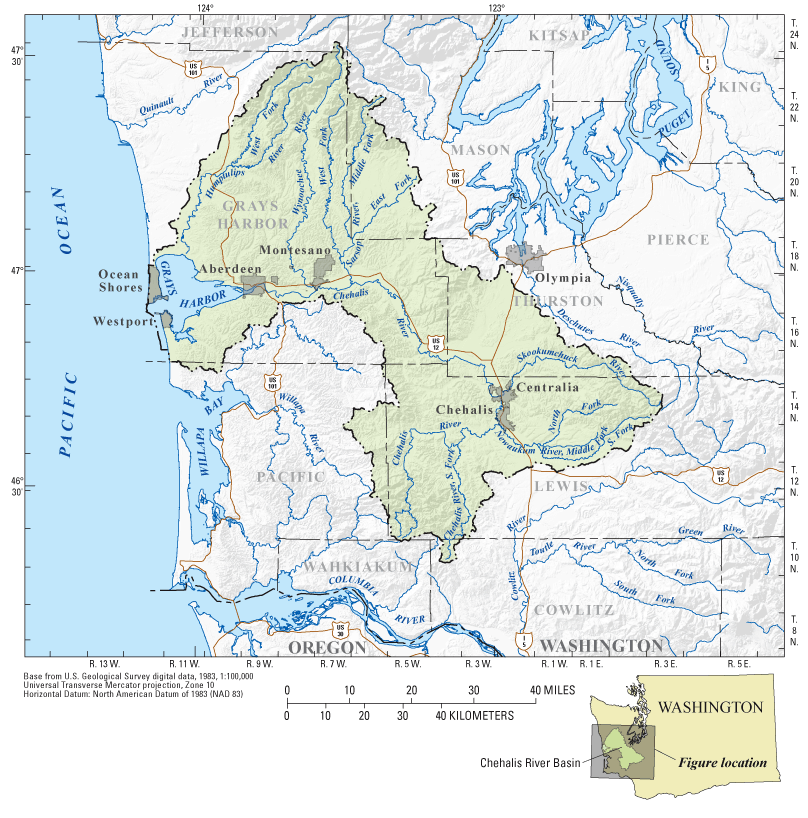
Figure 1. Map showing the Chehalis River basin study area, Washington. |
First posted June 23, 2010 For additional information contact: Part or all of this report is presented in Portable Document Format (PDF); the latest version of Adobe Reader or similar software is required to view it. Download the latest version of Adobe Reader, free of charge. |
Fasser, E.T., and Julich, R.H., 2010, Groundwater levels for selected wells in the Chehalis River basin, Washington: U.S. Geological Survey Data Series 512.

![]() U.S. Department of the Interior |
U.S. Geological Survey
U.S. Department of the Interior |
U.S. Geological Survey
URL: http://pubsdata.usgs.gov/pubs/ds/512/figure1.html
Page Contact Information: GS Pubs Web Contact
Page Last Modified: Monday, 28-Nov-2016 15:18:49 EST
