Digital Data Series 56
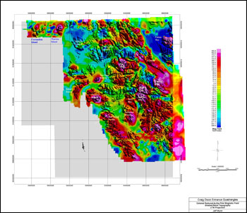
IntroductionThe U.S. Geological Survey (USGS) is required by the Alaska National Interest Lands Conservation Act (ANILCA, Public Law 96-487) to survey certain Federal lands to determine their mineral resource potential. As part of continuing studies designed to fulfill this responsibility, geochemical, geological and geophysical surveys of the Craig and Dixon Entrance (CDE) 1°x3° quadrangles in southeastern Alaska were undertaken by the USGS during the summers of 1983-85, 1989, and 1991. The geochemical data have been reported by Cathrall and others (1993) and Cathrall (1994). A simplified geologic map has been compiled especially for this report based largely on the work of Eberlein and others (1983) and Gehrels (1991, 1992). Brew (1996) also produced a compilation. This report presents available magnetic and gravity data and an interpretation thereof. In this report (released on CD-ROM in 1999) we are releasing USGS-acquired geophysical data for CDE 1:250,000-scale quadrangles of southeastern Alaska. Much of the data have never appeared before in the public domain, including a simplified geologic map, the raw gravity and magnetic data, and derivative products including depth-to-source images, various grids of the data, imaging representations, rock densities, and overlays of the data. In addition, we have added a limited interpretation of what the gravity and magnetic data indicate about the underlying geology, structures, and their relationship to known and potential hidden mineral resources. This interpretation is necessarily limited in the case of the gravity data by the general sparsity of stations. For convenience, we have also included here various representations of the digital topography. |
Posted online January 6, 2010
For additional information contact: This report may be purchased on CD-ROM from the USGS Store (Item 18588). Part or all of this report is presented in Portable Document Format (PDF); the latest version of Adobe Reader or similar software is required to view it. Download the latest version of Adobe Reader, free of charge. |
Wynn, J.C., Kucks, R.P., and Grybeck, D.J., 1999, An interpretation of the aeromagnetic and gravity data and derivative maps of the Craig and Dixon Entrance 1°x3° quadrangles and the western edges of the Ketchikan and Prince Rupert quadrangles, southeastern Alaska: U.S. Geological Survey Digital Data Series 56, 1 CD-ROM, also available online at https://pubs.usgs.gov/ds/56/.

![]() U.S. Department of the Interior |
U.S. Geological Survey
U.S. Department of the Interior |
U.S. Geological Survey
URL: http://pubsdata.usgs.gov/pubs/ds/56/index.html
Page Contact Information: USGS Publications Team
Page Last Modified: Monday, 28-Nov-2016 15:11:46 EST
