Data Series 560
|
|
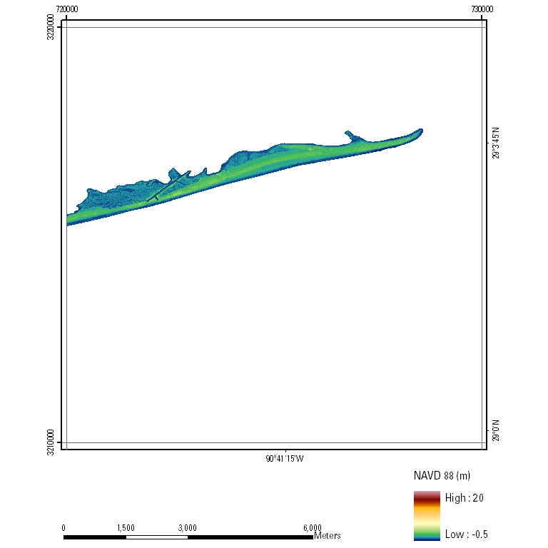
EAARL Coastal Topography–Eastern Louisiana Barrier Islands, Post-Hurricane Gustav, 2008: First SurfaceUTM Tile e720_n3220_15First-Surface Topography: 2.5-meter resolution
|

![]() U.S. Department of the
Interior | U.S. Geological Survey
U.S. Department of the
Interior | U.S. Geological Survey
URL: pubsdata.usgs.gov/pubs/ds/560/html/tile_htmls/e720_n3220_15.html
Page Contact Information: Feedback
Page Last Modified: Monday, 28-Nov-2016 16:13:14 EST