Data Series 578
|
|
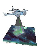
EAARL Coastal Topography–Cape Hatteras National Seashore, North Carolina, Post-Nor'Ida, 2009: Bare EarthMetadata
|

![]() U.S. Department of the
Interior | U.S. Geological Survey
U.S. Department of the
Interior | U.S. Geological Survey
URL: https://pubsdata.usgs.gov
/pubs/ds/578/html/metadata.html
Page Contact Information: Feedback
Page Last Modified: Monday, 28-Nov-2016 16:46:44 EST