Data Series 585
|
|
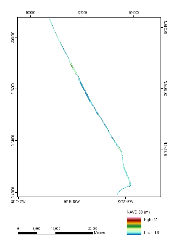
EAARL Coastal Topography–Cape Canaveral, Florida, 2009: First SurfaceFirst-Surface Mosaic: 2.5-meter Resolution
|

![]() U.S. Department of the
Interior | U.S. Geological Survey
U.S. Department of the
Interior | U.S. Geological Survey
URL: pubsdata.usgs.gov/pubs/ds/585/html/tile_htmls/mosaic_fs.html
Page Contact Information: Feedback
Page Last Modified: Monday, 28-Nov-2016 16:52:49 EST