U.S. Geological Survey Data Series 590
| Item | Details | Trackline Map – UTM Zone 16 |
|---|---|---|
| Minimum Northing Minimum Latitude |
3341362.8 30 11.7278' N |
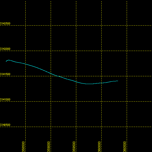 |
| Maximum Northing Maximum Latitude |
3341790.4 30 11.9747' N |
|
| Minimum Easting Minimum Longitude |
358105.8 088 28.4412' W |
|
| Maximum Easting Maximum Longitude |
360330.6 088 27.0582' W |
|Back|

![]() U.S. Department of the Interior |
U.S. Geological Survey
U.S. Department of the Interior |
U.S. Geological Survey
URL: http://pubsdata.usgs.gov/pubs/ds/590/maps/linenav/09cct03/09c503b_nav.html
Page Contact Information: Feedback
Page Last Modified: Monday, 28-Nov-2016 16:56:41 EST
