U.S. Geological Survey Data Series 590
| Navigation Statistics | ||
| Item | Description | Details |
| Minimum Northing Minimum Latitude |
3345034.6 30 13.5841' N |
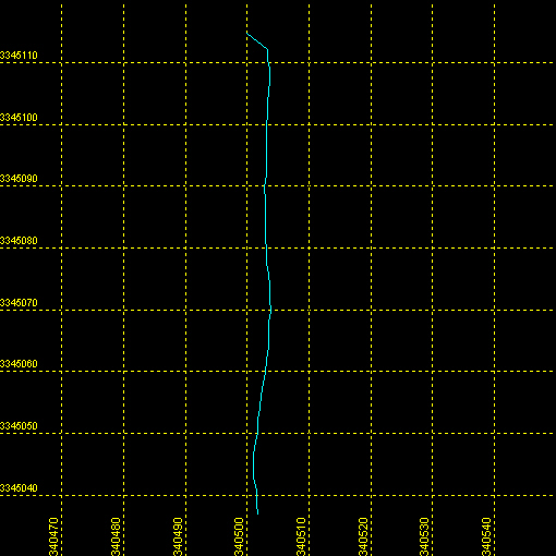 |
| Maximum Northing Maximum Latitude |
3345114.7 30 13.6275' N |
|
| Minimum Easting Minimum Longitude |
340498.7 088 39.4452' W |
|
| Maximum Easting Maximum Longitude |
340504.3 088 39.4424' W |
|
|Back|

![]() U.S. Department of the Interior |
U.S. Geological Survey
U.S. Department of the Interior |
U.S. Geological Survey
URL: http://pubsdata.usgs.gov/pubs/ds/590/maps/linenav/09cct03/09c551_nav.html
Page Contact Information: Feedback
Page Last Modified: Monday, 28-Nov-2016 16:57:44 EST
