U.S. Geological Survey Data Series 590
| Navigation Statistics | ||
| Item | Description | Details |
| Minimum Northing Minimum Latitude |
3343095.5 30 12.5436' N |
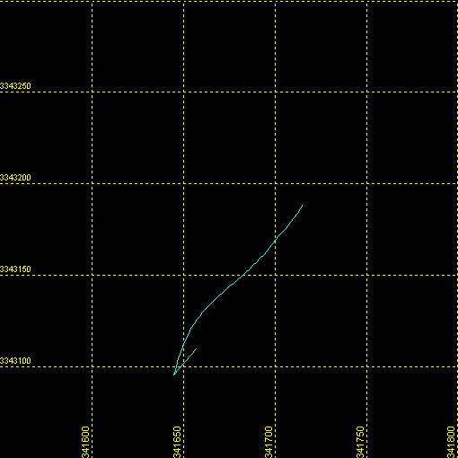 |
| Maximum Northing Maximum Latitude |
3343188.7 30 12.5946' N |
|
| Minimum Easting Minimum Longitude |
341644.4 088 38.7136' W |
|
| Maximum Easting Maximum Longitude |
341715.6 088 38.6701' W |
|
|Back|

![]() U.S. Department of the Interior |
U.S. Geological Survey
U.S. Department of the Interior |
U.S. Geological Survey
URL: http://pubsdata.usgs.gov/pubs/ds/590/maps/linenav/09cct04/09i48a_nav.html
Page Contact Information: Feedback
Page Last Modified: Monday, 28-Nov-2016 16:56:25 EST
