Data Series 616
|
|
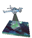
EAARL Coastal Topography–Northern Outer Banks, North Carolina, Post-Nor'Ida, 2009Metadata
|

![]() U.S. Department of the Interior |
U.S. Geological Survey
U.S. Department of the Interior |
U.S. Geological Survey
URL: http://pubsdata.usgs.gov/pubs/ds/616/html/metadata.html
Page Contact Information: GS Pubs Web Contact
Page Last Modified: Monday, 28-Nov-2016 17:36:15 EST