Data Series 617
|
|
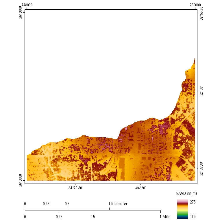
EAARL Topography–Potato Creek Watershed, Georgia, 2010UTM Tile e748_n3648_16First-Surface Topography: 2.5-meter resolution
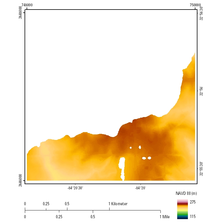
Bare-Earth Topography: 2.5-meter resolution
|

![]() U.S. Department of the Interior |
U.S. Geological Survey
U.S. Department of the Interior |
U.S. Geological Survey
URL: http://pubsdata.usgs.gov/pubs/ds/617/html/tile_htmls/e748_n3648_16.html
Page Contact Information: GS Pubs Web Contact
Page Last Modified: Monday, 28-Nov-2016 17:43:13 EST