Data Series 618
|
|
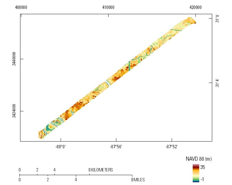
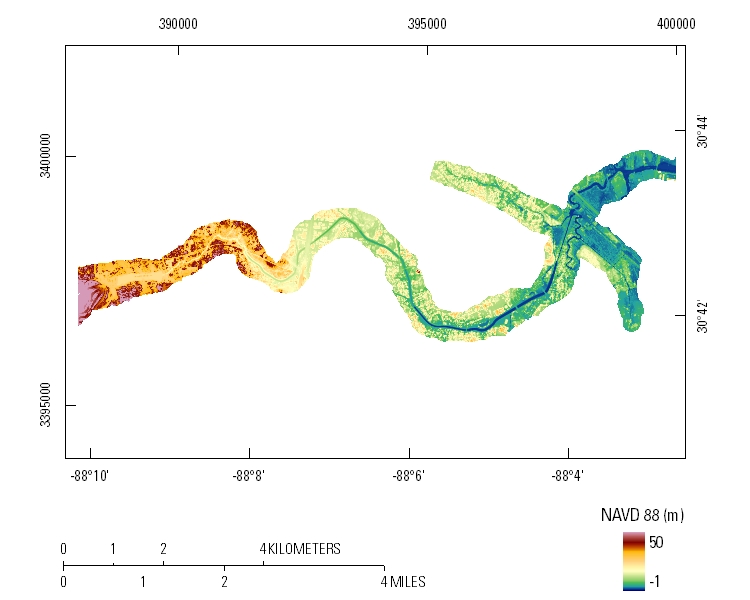
EAARL Topography–Three Mile Creek and Mobile-Tensaw Delta, Alabama, 2010First-Surface Mosaics: 2.5-meter resolutionMobile-Tensaw Delta
Three Mile Creek
|

![]() U.S. Department of the Interior |
U.S. Geological Survey
U.S. Department of the Interior |
U.S. Geological Survey
URL: http://pubsdata.usgs.gov/pubs/ds/618/html/tile_htmls/mosaics_fs.html
Page Contact Information: GS Pubs Web Contact
Page Last Modified: Monday, 28-Nov-2016 17:48:48 EST