U.S. Geological Survey Data Series 647
| Item | Details | Trackline Map – UTM Zone 17 |
|---|---|---|
| Minimum Northing Minimum Latitude |
3276346.3 29° 37.0143' N |
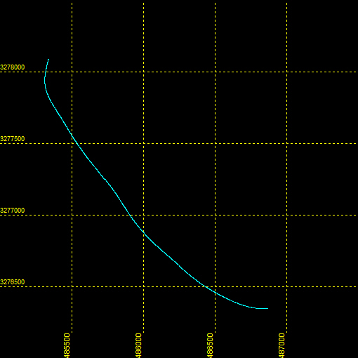 |
| Maximum Northing Maximum Latitude |
3278088.3 29° 37.9587' N |
|
| Minimum Easting Minimum Longitude |
485305.6 081° 09.1066' W |
|
| Maximum Easting Maximum Longitude |
486877.9 081° 08.1334' W |
|Back|

![]() U.S. Department of the Interior |
U.S. Geological Survey
U.S. Department of the Interior |
U.S. Geological Survey
Page Contact Information: Feedback
Page Last Modified: September 27, 2012
