Data Series 674
|
|
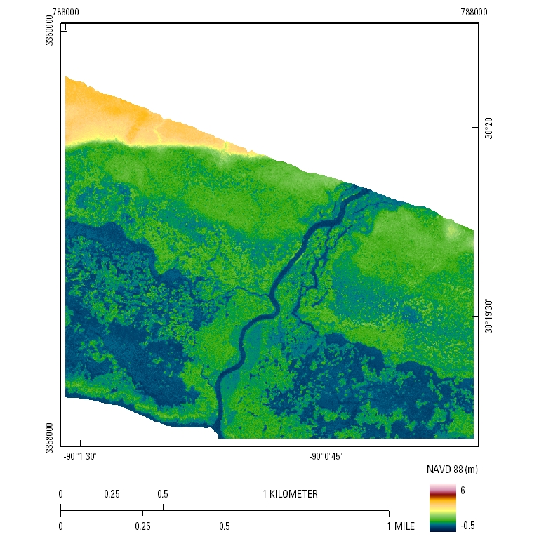
EAARL Coastal Topography–North Shore, Lake Pontchartrain, Louisiana, 2010UTM Tile e786_n3360_15Coastal Topography: 2.5-meter resolution
|

![]() U.S. Department of the Interior |
U.S. Geological Survey
U.S. Department of the Interior |
U.S. Geological Survey
URL: http://pubsdata.usgs.gov/pubs/ds/674/html/tile_htmls/e786_n3360_15.html
Page Contact Information: GS Pubs Web Contact
Page Last Modified: Monday, 28-Nov-2016 18:38:41 EST