 Abstract Abstract
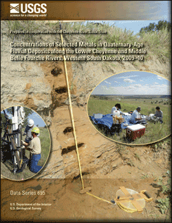
The headwaters of the Cheyenne and Belle Fourche Rivers drain the Black Hills of South Dakota and Wyoming, an area that has been affected by mining and ore-milling operations since the discovery of gold in 1875. A tributary to the Belle Fourche River is Whitewood Creek, which drains the area of the Homestake Mine, a gold mine that operated from 1876 to 2001. Tailings discharged into Whitewood Creek contained arsenopyrite, an arsenic-rich variety of pyrite associated with gold ore, and mercury used as an amalgam during the gold-extraction process. Approximately 18 percent of the tailings that were discharged remain in fluvial deposits on the flood plain along Whitewood Creek, and approximately 25 percent remain in fluvial deposits on the flood plain along the Belle Fourche River, downstream from Whitewood Creek. In 1983, a 29-kilometer (18-mile) reach of Whitewood Creek and the adjacent flood plain was included in the U.S. Environmental Protection Agency’s National Priority List of the Comprehensive Environmental Response, Compensation, and Liability Act of 1980, commonly referred to as a “Superfund site.” Listing of this reach of Whitewood Creek was primarily in response to arsenic toxicity of fluvial deposits on the flood plain.
Lands along the lower Cheyenne River were transferred to adjoining States and Tribes in response to the Water Resources Development Act (WRDA) of 1999. An amendment in 2000 to WRDA required a study of sediment contamination of the Cheyenne River. In response to the WRDA amendment, the U.S. Geological Survey completed field sampling of reference sites (not affected by mine-tailing disposal) along the lower Belle Fourche and lower Cheyenne Rivers. Reference sites were located on stream terraces that were elevated well above historical stream stages to ensure no contamination from historical mining activity. Sampling of potentially contaminated sites was performed on transects of the active flood plain and adjacent terraces that could potentially be inundated during high-flow events. Sampling began in 2009 and was completed in 2010. A total of 74 geochemical samples were collected from fluvial deposits at reference sites, and 473 samples were collected from potentially contaminated sites. Sediment samples collected were analyzed for 23 metals, including arsenic and mercury. Sequential replicate, split duplicate, and field quality-control samples were analyzed for quality assurance of data-collection methods. The metal concentrations in sediment samples and location information are presented in this report in electronic format (Microsoft Excel), along with non-parametric summary statistics of those data. Cross-sectional topography is graphed with arsenic and mercury concentrations on transects at the potentially contaminated sites. The mean arsenic concentration in reference sediment samples was 8 milligrams per kilogram (mg/kg), compared to 250, 650, and 76 mg/kg for potentially contaminated sediment samples at the surface of the middle Belle Fourche River site, the subsurface of the middle Belle Fourche River site, and the surface of the lower Cheyenne River site, respectively. The mean mercury concentration in reference sediment samples was 16 micrograms per kilogram (μg/kg), compared to 130, 370, and 71 μg/kg for potentially contaminated sediment samples at the surface of the middle Belle Fourche River site, the subsurface of the middle Belle Fourche River site, and the surface of the lower Cheyenne River site, respectively.
|
First posted July 25, 2012
Part or all of this report is presented in Portable Document Format (PDF); the latest version of Adobe Reader or similar software is required to view it. Download the latest version of Adobe Reader, free of charge. |

