Data Series 720

LIDAR Illustration

Home Link

Purpose Link

Metadata Link

Collaborators

Acronyms Link

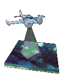
EAARL Coastal Topography and Imagery–Western Louisiana, Post-Hurricane Rita, 2005: First Surface


Collaborators


Funding for this project was provided by the U.S. Geological Survey - Coastal and Marine Geology Program.


U.S. Geological Survey Logo and Link

U.S. Geological Survey

Coastal and Marine Geology Program

St. Petersburg Coastal and Marine Science Center


NASA Cooperator Logo and Link

National Aeronautics and Space Administration

Wallops Flight Facility


Back to Index Page


Accessibility FOIA Privacy Policies and Notices

Take Pride in America logo USA.gov logo U.S. Department of the Interior | U.S. Geological Survey
URL: http://pubsdata.usgs.gov/pubs/ds/720/html/collaborators.html
Page Contact Information: GS Pubs Web Contact
Page Last Modified: Monday, 28-Nov-2016 19:15:03 EST