Skip Links

USGS - science for a changing world

Data Series 746

Prepared in cooperation with the National Park Service

Historical Rock Falls in Yosemite National Park, California (1857–2011)

By Greg M. Stock, Brian D. Collins, David J. Santaniello, Valerie L. Zimmer, Gerald F. Wieczorek, and James B. Snyder

Thumbnail of and link to report PDF (6.2 MB)Summary

Inventories of rock falls and other types of landslides are valuable tools for improving understanding of these events. For example, detailed information on rock falls is critical for identifying mechanisms that trigger rock falls, for quantifying the susceptibility of different cliffs to rock falls, and for developing magnitude-frequency relations. Further, inventories can assist in quantifying the relative hazard and risk posed by these events over both short and long time scales.

This report describes and presents the accompanying rock fall inventory database for Yosemite National Park, California. The inventory database documents 925 events spanning the period 1857–2011. Rock falls, rock slides, and other forms of slope movement represent a serious natural hazard in Yosemite National Park. Rock-fall hazard and risk are particularly relevant in Yosemite Valley, where glacially steepened granitic cliffs approach 1 km in height and where the majority of the approximately 4 million yearly visitors to the park congregate. In addition to damaging roads, trails, and other facilities, rock falls and other slope movement events have killed 15 people and injured at least 85 people in the park since the first documented rock fall in 1857.

The accompanying report describes each of the organizational categories in the database, including event location, type of slope movement, date, volume, relative size, probable trigger, impact to humans, narrative description, references, and environmental conditions. The inventory database itself is contained in a Microsoft Excel spreadsheet (Yosemite_rock_fall_database_1857-2011.xlsx). Narrative descriptions of events are contained in the database, but are also provided in a more readable Adobe portable document format (pdf) file (Yosemite_rock_fall_database_narratives_1857-2011.pdf) available for download separate from the database.

First posted June 17, 2013

For additional information:
Contact Information, Geology, Minerals, Energy, and Geophysics Science Center—Menlo Park
U.S. Geological Survey
345 Middlefield Road, MS-973
Menlo Park, CA 94025-3591
http://geomaps.wr.usgs.gov/gmeg/

Part of this report is presented in Portable Document Format (PDF); the latest version of Adobe Reader or similar software is required to view it. Download the latest version of Adobe Reader, free of charge.


Suggested citation:

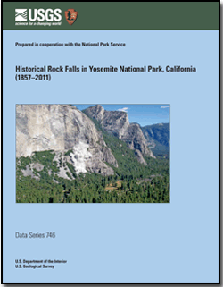
Stock, G.M., Collins, B.D., Santaniello, D.J., Zimmer, V.L., Wieczorek, G.F., and Snyder, J.B., 2013, Historical rock falls in Yosemite National Park, California (1857–2011): U.S. Geological Survey Data Series 746, 17 p. and data files, https://pubs.usgs.gov/ds/746/.


Contents

Introduction

Historical Rock Fall Records

Methods

Data Files

Summary

Acknowledgments

References Cited

Narratives

Database


Accessibility FOIA Privacy Policies and Notices

Take Pride in America logo USA.gov logo U.S. Department of the Interior | U.S. Geological Survey
URL: http://pubsdata.usgs.gov/pubs/ds/746/index.html
Page Contact Information: GS Pubs Web Contact
Page Last Modified: Monday, 28-Nov-2016 19:11:01 EST