Geology and geomorphology--Offshore of Bodega Head Map Area, California

Metadata:

Identification_Information:
Citation:
Citation_Information:
Originator: S.Y. Johnson
Originator: S.R. Hartwell
Originator: M.W. Manson
Publication_Date: 2014
Title:
Geology and geomorphology--Offshore of Bodega Head Map Area, California
Geospatial_Data_Presentation_Form: vector digital data
Series_Information:
Series_Name: Data Series
Issue_Identification: DS 781
Publication_Information:
Publication_Place: Reston, VA
Publisher: U.S. Geological Survey
Online_Linkage: https://doi.org/10.3133/ds781
Online_Linkage: Larger_Work_Citation:
Citation_Information:
Originator: Nadine E. Golden
Publication_Date: 2013
Title: California State Waters Map Series Data Catalog
Geospatial_Data_Presentation_Form: database
Series_Information:
Series_Name: Data Series
Issue_Identification: DS 781
Publication_Information:
Publication_Place: Reston, VA
Publisher: U.S. Geological Survey
Online_Linkage: http://pubs.usgs.gov/ds/781/
Description:
Abstract:
This part of DS 781 presents data for the geologic and geomorphic map of the Offshore of Bodega Head map area, California. The vector data file is included in "Geology_OffshoreBodegaHead.zip," which is accessible from https://pubs.usgs.gov/ds/781/OffshoreBodegaHead/data_catalog_OffshoreBodegaHead.html. These data accompany the pamphlet and map sheets of Johnson, S.Y., Dartnell, P., Golden, N.E., Hartwell, S.R., Erdey, M.D., Greene, H.G., Cochrane, G.R., Kvitek, R.G., Manson, M.W., Endris, C.A., Dieter, B.E., Watt, J.T., Krigsman, L.M., Sliter, R.W., Lowe, E.N., and Chin, J.L. (S.Y. Johnson and S.A. Cochran, eds.), 2015, California State Waters Map Series—Offshore of Bodega Head, California: U.S. Geological Survey Open-File Report 2015–1140, pamphlet 39 p., 10 sheets, scale 1:24,000, https://doi.org/10.3133/ofr20151140.
Marine geology and geomorphology was mapped in the Offshore of Bodega Head map area, California, from approximate Mean High Water (MHW) to the 3-nautical-mile limit of California'€™s State Waters. Offshore geologic units were delineated on the basis of integrated analyses of adjacent onshore geology with multibeam bathymetry and backscatter imagery, seafloor-sediment and rock samples, digital camera and video imagery, and high-resolution seismic-reflection profiles.
Purpose:
To expand geologic mapping to the seafloor within the California's State Waters, to update coastal geologic mapping, and to contribute to a uniform regional geologic database, which can be used geographic information systems. Additionally, to provide a geologic map for the public and geoscience community to aid in assessments and mitigation of geologic hazards in the Drakes Bay coastal region and to provide sufficient geologic information for land-use and land-management decisions both onshore and offshore. This information is not intended for navigational purposes.
Supplemental_Information:
Additional information about the field activity from which some of these data were derived is available online at:
https://cmgds.marine.usgs.gov/fan_info.php?fan=S809NC
Any use of trade, product, or firm names is for descriptive purposes only and does not imply endorsement by the U.S. Government.
Although this Federal Geographic Data Committee-compliant metadata file is intended to document the data set in nonproprietary form, as well as in Esri format, this metadata file may include some Esri-specific terminology.
Time_Period_of_Content:
Time_Period_Information:
Range_of_Dates/Times:
Beginning_Date: 2006
Ending_Date: 2010
Currentness_Reference: ground condition
Status:
Progress: Complete
Maintenance_and_Update_Frequency: none planned
Spatial_Domain:
Bounding_Coordinates:
West_Bounding_Coordinate: -123.17
East_Bounding_Coordinate: -122.97
North_Bounding_Coordinate: 38.41
South_Bounding_Coordinate: 38.25
Keywords:
Theme:
Theme_Keyword_Thesaurus: USGS Metadata Identifier
Theme_Keyword: USGS:81a3a157-7d52-4220-9e03-f782d9a843b9
Theme:
Theme_Keyword_Thesaurus: ISO 19115 Topic Category
Theme_Keyword: geoscientificInformation
Theme_Keyword: environment
Theme_Keyword: oceans
Theme_Keyword: imageryBaseMapsEarthCover
Theme:
Theme_Keyword_Thesaurus: None
Theme_Keyword: U.S. Geological Survey
Theme_Keyword: USGS
Theme_Keyword: Coastal and Marine Hazards and Resources
Theme_Keyword: CMHRP
Theme_Keyword: Pacific Coastal and Marine Science Center
Theme_Keyword: PCMSC
Theme:
Theme_Keyword_Thesaurus: Marine Realms Information Bank (MRIB) keywords
Theme_Keyword: seabed
Theme_Keyword: marine geology
Theme_Keyword: geologic mapping
Theme:
Theme_Keyword_Thesaurus: USGS Thesaurus
Theme_Keyword: geologic maps
Theme_Keyword: marine geology
Theme_Keyword: sea-floor characteristics
Theme_Keyword: maps and atlases
Theme_Keyword: geospatial datasets
Theme:
Theme_Keyword_Thesaurus: Coastal and Marine Ecological Classification Standard (CMECS)
Theme_Keyword: Marine Nearshore Subtidal
Theme_Keyword: Marine Offshore Subtidal
Theme_Keyword: Transform Continental Margin
Theme_Keyword: Continental/Island Shelf
Theme_Keyword: Rock Substrate
Theme_Keyword: Unconsolidated Mineral Substrate
Place:
Place_Keyword_Thesaurus: Geographic Names Information System (GNIS)
Place_Keyword: Pacific Ocean
Place_Keyword: State of California
Place_Keyword: Bodega Bay
Place_Keyword: Sonoma County
Place_Keyword: Salmon Creek
Place:
Place_Keyword_Thesaurus: Coastal and Marine Ecological Classification Standard (CMECS)
Place_Keyword: Northern California Ecoregion
Stratum:
Stratum_Keyword_Thesaurus: Coastal and Marine Ecological Classification Standard (CMECS)
Stratum_Keyword: Substrate
Access_Constraints: none
Use_Constraints:
USGS-authored or produced data and information are in the public domain from the U.S. Government and are freely redistributable with proper metadata and source attribution. Please recognize and acknowledge the U.S. Geological Survey as the originator(s) of the dataset and in products derived from these data. This information is not intended for navigation purposes.
Point_of_Contact:
Contact_Information:
Contact_Organization_Primary:
Contact_Organization:
U.S. Geological Survey, Pacific Coastal and Marine Science Center
Contact_Person: PCMSC Science Data Coordinator
Contact_Address:
Address_Type: mailing and physical
Address: 2885 Mission Street
City: Santa Cruz
State_or_Province: CA
Postal_Code: 95060-5792
Country: US
Contact_Voice_Telephone: 831-427-4747
Contact_Electronic_Mail_Address: pcmsc_data@usgs.gov
Browse_Graphic:
Browse_Graphic_File_Name: Browse_Graphic_File_Description: Geology and geomorphology offshore of Bodega Head.
Browse_Graphic_File_Type: JPEG
Native_Data_Set_Environment:
Microsoft Windows Server 2008 R2 Version 6.1 (Build 7601) Service Pack 1; ESRI ArcCatalog 10.0
Cross_Reference:
Citation_Information:
Originator: Johnson, S.Y.
Originator: Dartnell, P.
Originator: Golden, N.E.
Originator: Hartwell, S.R.
Originator: Erdey, M.D.
Originator: Greene, H.G.
Originator: Cochrane, G.R.
Originator: Kvitek, R.G.
Originator: Manson, M.W.
Originator: Endris, C.A.
Originator: Dieter, B.E.
Originator: Watt, J.T.
Originator: Krisgman, L.M.
Originator: Sliter, R.W.
Originator: Lowe, E.N.
Originator: Chin, J.L.
Publication_Date: 2015
Title:
California State Waters Map Series--Offshore of Bodega Head, California
Series_Information:
Series_Name: Open-File Report
Issue_Identification: 2015-1140
Publication_Information:
Publication_Place: Reston, VA
Publisher: U.S. Geological Survey
Online_Linkage: https://doi.org/10.3133/ofr20151140
Data_Quality_Information:
Logical_Consistency_Report:
Map elements were visually checked for overshoots, undershoots, duplicate features, polygon closure, and other errors by the lead authors and by the GIS technician(s) who created the digital database. Review drafts of the map were reviewed internally by at least two other geologists for consistency with basic geologic principles and general conformity to USGS mapping standards.
Completeness_Report:
Data are complete: no offshore features that could be accurately identified and represented at the compilation scale of 1:24,000 were eliminated or generalized. The smallest area represented is approximately 100 square meters. All geospatial database elements are attributed.
Positional_Accuracy:
Horizontal_Positional_Accuracy:
Horizontal_Positional_Accuracy_Report:
Polygons were primarily mapped by one of the following methods: (1) interpretation of 2-meter-resolution hillshaded bathymetry data from bathymetric lidar and sonar surveys (see Bathymetry Hillshade--Offshore Bodega Head, California, California, DS 781, for more information); (2) interpretation of 2-meter-resolution amplitude (backscatter) data from bathymetric sonar surveys (see BackscatterA_8101; BackscatterB_7125; BackscatterC_Swath--Offshore Bodega Head, California, DS 781, for more information); (3) interpretation of 2-meter interpretation of seismic-reflection-profile data (see field activity S-08-09-NC).
Map Unit contact locations were interpreted typically at a scale of between 1:1,000 and 1:2,000 using the above base data. Bathymetric sonar and LiDAR data have a horizontal accuracy greater than the resolution of the base data.
Map unit contacts were digitized by heads-up screen digitization of line data on 2-meter-resolution DEMs described above. Horizontal accuracy is estimated to be between 2 and 5 meters depending on how clearly contacts can be resolved.
Most digitized positions on the map are estimated to have better than 5 m horizontal accuracy. There is no elevation data in the database.
Lineage:
Source_Information:
Source_Citation:
Citation_Information:
Originator: Peter Dartnell
Originator: Rikk G. Kvitek
Publication_Date: 2013
Title: Bathymetry--Offshore of Bodega Head Map Area, California
Geospatial_Data_Presentation_Form: raster digital data
Series_Information:
Series_Name: Data Series
Issue_Identification: DS 781
Publication_Information:
Publication_Place: Reston, VA
Publisher: U.S. Geological Survey
Other_Citation_Details:
See metadata for bathymetry ("Bathymetry_OffshoreBodegaHead_metadata.txt" and "BathymetryHS_OffshoreBodegaHead_metadata.txt") in DS 781 for source data and postprocessing/reprocessing information.
Online_Linkage: Online_Linkage:
Type_of_Source_Media: digital file of gridded bathymetry data (ArcInfo GRID)
Source_Time_Period_of_Content:
Time_Period_Information:
Range_of_Dates/Times:
Beginning_Date: 2007
Ending_Date: 2010
Source_Currentness_Reference: ground condition
Source_Citation_Abbreviation: DS 781
Source_Contribution: Gridded bathymetry data (2-meter resolution).
Source_Information:
Source_Citation:
Citation_Information:
Originator: Peter Dartnell
Originator: Rikk G. Kvitek
Publication_Date: 2013
Title: Backscatter--Offshore of Bodega Head Map Area, California
Geospatial_Data_Presentation_Form: raster digital data
Series_Information:
Series_Name: Data Series
Issue_Identification: DS 781
Publication_Information:
Publication_Place: Reston, VA
Publisher: U.S. Geological Survey
Other_Citation_Details:
See metadata for backscatter data ("BackscatterA_8101_OffshoreBodegaHead_metadata.txt", "BackscatterB_7125_OffshoreBodegaHead_metadata.txt", and "BackscatterC_Swath_OffshoreBodegaHead_metadata.txt") in DS 781 for amplitude source data and postprocessing/reprocessing information.
Online_Linkage: Online_Linkage: Online_Linkage:
Type_of_Source_Media: digital file of gridded amplitude data (ArcInfo GRID)
Source_Time_Period_of_Content:
Time_Period_Information:
Range_of_Dates/Times:
Beginning_Date: 2006
Ending_Date: 2007
Source_Currentness_Reference: ground condition
Source_Citation_Abbreviation: DS 781
Source_Contribution: Gridded amplitude data (2-meter resolution).
Source_Information:
Source_Citation:
Citation_Information:
Originator: Ray W. Sliter
Originator: Samuel Y. Johnson
Originator: John L. Chin
Originator: Parker Allwardt
Originator: Jeffrey Beeson
Originator: Peter J. Triezenberg
Publication_Date: 2016
Title:
High-resolution seismic-reflection data from offshore of northern California—Bolinas to Sea Ranch
Publication_Information:
Publication_Place: Menlo Park, CA
Publisher: U.S. Geological Survey
Online_Linkage: https://doi.org/10.3133/ofr20161058
Type_of_Source_Media: ASCII lat/long shot point files
Source_Time_Period_of_Content:
Time_Period_Information:
Range_of_Dates/Times:
Beginning_Date: 20090908
Ending_Date: 20090930
Source_Currentness_Reference: ground condition
Source_Citation_Abbreviation: seismic
Source_Contribution:
Digital seismic data used to interpret subsurface geologic structure
Source_Information:
Source_Citation:
Citation_Information:
Originator: Jane A. Reid
Originator: Jamey M. Reid
Originator: Chris J. Jenkins
Originator: Mark Zimmerman
Originator: S. Jeffress Williams
Originator: Michael E. Field
Publication_Date: 2006
Title:
usSEABED—Pacific Coast (California, Oregon, Washington) offshore surficial-sediment data release
Series_Information:
Series_Name: Data Series
Issue_Identification: DS 182
Publication_Information:
Publication_Place: Menlo Park, CA
Publisher: U.S. Geological Survey
Online_Linkage: https://doi.org/10.3133/ds182
Type_of_Source_Media: Esri project files, csv files
Source_Time_Period_of_Content:
Time_Period_Information:
Single_Date/Time:
Calendar_Date: 2006
Source_Currentness_Reference: publication date
Source_Citation_Abbreviation: sediment
Source_Contribution:
seafloor sediment and rock samples used to interpret seafloor geology
Source_Information:
Source_Citation:
Citation_Information:
Originator: Nadine E. Golden
Originator: Guy R. Cochran
Publication_Date: 2013
Title: California Seafloor Mapping Program video and photograph portal
Series_Information:
Series_Name: data release
Issue_Identification: DOI:10.5066/F7J1015K
Publication_Information:
Publication_Place: Pacific Coastal and Marine Science Center, Santa Cruz, CA
Publisher: U.S. Geological Survey
Online_Linkage: https://doi.org/10.5066/F7J1015K
Type_of_Source_Media: seafloor video and photographs
Source_Time_Period_of_Content:
Time_Period_Information:
Single_Date/Time:
Calendar_Date: 2013
Source_Currentness_Reference: publication date
Source_Citation_Abbreviation: imagery
Source_Contribution:
seafloor video and photographs used to interpret seafloor geology
Process_Step:
Process_Description:
Map unit polygons were digitized over underlying 2-meter base layers developed from multibeam bathymetry and backscatter data. Derivatives such as slope and curvature were generated from source rasters. Interpreted rasters include amplitude, hillshaded bathymetry (using various illumination angles and vertical exaggeration), slope, and curvature. Curvature was decomposed into profile and plan curvature for analysis purposes.
Source_Used_Citation_Abbreviation: bathymetry
Source_Used_Citation_Abbreviation: backscatter
Source_Used_Citation_Abbreviation: seismic
Source_Used_Citation_Abbreviation: sediment
Source_Used_Citation_Abbreviation: imagery
Process_Date: 2012
Process_Step:
Process_Description:
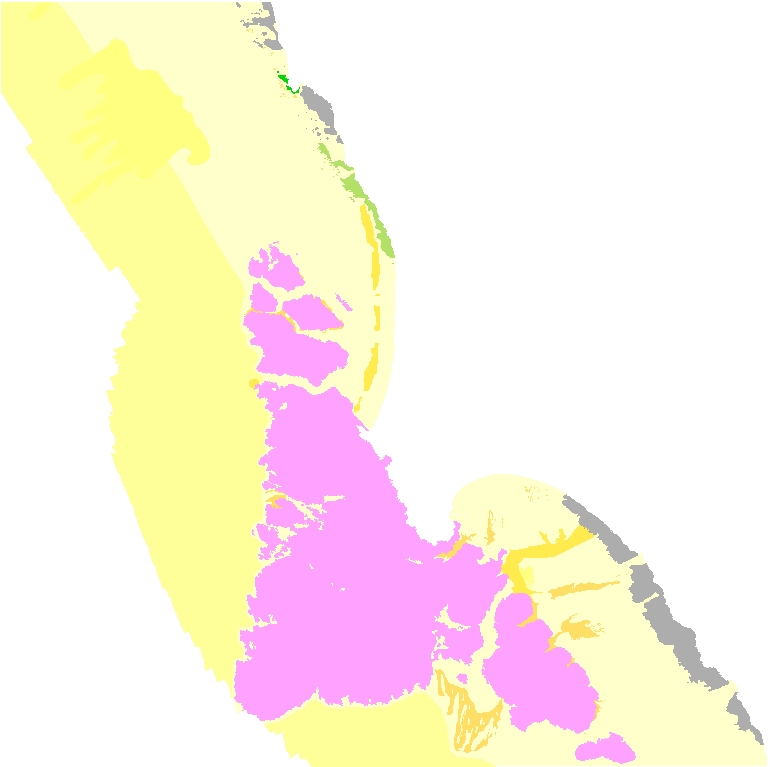
The mapped area was extended to the shoreline by using digital orthophotos to interpret the region between the inner edge of the multibeam bathymetry and the approximate shoreline. The approximate shoreline was generated at the NAVD88 +1.46 m contour, defined as the operational MHW shoreline by Weber and others (2005). The resulting boundary was transformed to WGS 84 UTM Zone 10 North in ArcGIS 10 using the NAD83 to WGS84 (ITRF00) transformation algorithm. This boundary was then used to extend and trim both onshore and offshore geology in the print and PDF product. The transformed boundary is contained within the WGS84 "contours" feature class and identified as a water boundary in the associated representation rules.
Only data for offshore map units are released digitally in this publication. For onshore geology see Blake and others (2002) and Wagner and Gutierrez (2010, and 2017). Quaternary mapping units are as defined by Witter and others (2006) and Wagner and Gutierrez (2010), with unit contacts modified based on analysis of 2003 LiDAR and 2004 IfSAR and data; and additional unpublished mapping by M.W. Manson. San Andreas Fault traces are from Brown and Wolfe (1972), California Geological Survey (1974) and previously unpublished mapping by M.W. Manson.
References Cited:
Blake, M.C., Jr., Graymer, R.W., and Stamski, R.E., 2002, Geologic map and map database of western Sonoma, northernmost Marin, and southernmost Mendocino counties, California: U.S. Geological Survey Miscellaneous Field Studies Map 2402, scale 1:100,000.
Brown, R.D., Jr., and Wolfe, E.W., 1972, Map showing recently active breaks along the San Andreas Fault between Point Delgada and Bolinas Bay, California: U.S. Geological Survey Miscellaneous Investigations Map I-692, scale 1:24,000.
California Geological Survey, 1974, Alquist-Priolo Earthquake Fault Zone Maps of Bodega Head, Duncans Mills and Valley Ford quadrangles, scale 1:24,000.
Fuller, M.S., Haydon, W.D., Purcell, M.G., and Custis, K., 2002, Geologic and geomorphic features related to landsliding, Gualala River watershed, Sonoma and Mendocino counties, California: California Geological Survey Watershed Mapping Series, Map Set 5, Plate 1, Sheet 3 of 3, scale 1:24,000.
Manson, M.W., Huyette, C.M., Wills, C.J., Huffman, M.E., Smelser, G.G., Fuller, M.E., Domrose, C., and Gutierrez, C., 2006, Landslides in the Highway 1 corridor between Bodega Bay and Fort Ross, Sonoma County, California: California Geological Survey Special Report 196, 26 p., 2 plates, 38 maps, scale 1:12,000.
Wagner, D.L., and Gutierrez, C.I., 2010, Preliminary Geologic Map of the Napa 30' x 60' Quadrangle, California: California Geological Survey, scale 1:100,000.
Wagner, D.L., and Gutierrez, C.I., 2017, Preliminary Geologic Map of the Bodega Bay 30' x 60' Quadrangle, California: California Geological Survey, scale 1:100,000.
Weber, K.M., List, J.H., and Morgan, K.L., 2005, An operational Mean High Water datum for determination of shoreline position from topographic lidar data: U.S. Geological Survey Open-File Report 2005-1027, accessed April 5, 2011, at http://pubs.usgs.gov/of/2005/1027/.
Witter, R.C., Knudsen, K.L., Sowers, J.M., Wentworth, C.M., Koehler, R.D., Randolph, C.E., Brooks, S.K., and Gans, K.D., 2006, Maps of Quaternary Deposits and Liquefaction Susceptibility in the Central San Francisco Bay Region, California, U.S. Geological Survey Open-File Report 06-1037, scale 1:24,000.
Process_Date: 2013
Process_Step:
Process_Description:
Added Distribution_Information section to metadata to facilitate data download.
Process_Date: 20171005
Process_Contact:
Contact_Information:
Contact_Organization_Primary:
Contact_Organization: U.S. Geological Survey
Contact_Person: Alan O. Allwardt
Contact_Position: Contractor -- Information Specialist
Contact_Address:
Address_Type: mailing and physical address
Address: 2885 Mission Street
City: Santa Cruz
State_or_Province: CA
Postal_Code: 95060
Contact_Voice_Telephone: 831-460-7551
Contact_Facsimile_Telephone: 831-427-4748
Contact_Electronic_Mail_Address: aallwardt@usgs.gov
Process_Step:
Process_Description:
Keywords section of metadata optimized for discovery in USGS Coastal and Marine Geology Data Catalog.
Process_Date: 20171005
Process_Contact:
Contact_Information:
Contact_Organization_Primary:
Contact_Organization: U.S. Geological Survey
Contact_Person: Alan O. Allwardt
Contact_Position: Contractor -- Information Specialist
Contact_Address:
Address_Type: mailing and physical address
Address: 2885 Mission Street
City: Santa Cruz
State_or_Province: CA
Postal_Code: 95060
Contact_Voice_Telephone: 831-460-7551
Contact_Facsimile_Telephone: 831-427-4748
Contact_Electronic_Mail_Address: aallwardt@usgs.gov
Process_Step:
Process_Description:
Added keywords from Coastal and Marine Ecological Classification Standard (CMECS) to metadata.
Process_Date: 20180426
Process_Contact:
Contact_Information:
Contact_Organization_Primary:
Contact_Organization: U.S. Geological Survey
Contact_Person: Alan O. Allwardt
Contact_Position: Contractor -- Information Specialist
Contact_Address:
Address_Type: mailing and physical address
Address: 2885 Mission Street
City: Santa Cruz
State_or_Province: CA
Postal_Code: 95060
Contact_Voice_Telephone: 831-460-7551
Contact_Facsimile_Telephone: 831-427-4748
Contact_Electronic_Mail_Address: aallwardt@usgs.gov
Process_Step:
Process_Description:
Edited metadata to add keywords section with USGS persistent identifier as theme keyword. No data were changed.
Process_Date: 20201019
Process_Contact:
Contact_Information:
Contact_Organization_Primary:
Contact_Organization: U.S. Geological Survey
Contact_Person: VeeAnn A. Cross
Contact_Position: Marine Geologist
Contact_Address:
Address_Type: Mailing and Physical
Address: 384 Woods Hole Road
City: Woods Hole
State_or_Province: MA
Postal_Code: 02543-1598
Contact_Voice_Telephone: 508-548-8700 x2251
Contact_Facsimile_Telephone: 508-457-2310
Contact_Electronic_Mail_Address: vatnipp@usgs.gov
Process_Step:
Process_Description:
Edited metadata to fix validation errors and to bring it up to FGDC CSDGM current standards based on data release policies for USGS Coastal and Marine Hazards and Resources Program (CMHRP). No data were changed. The metadata available from a harvester may supersede metadata bundled within a download file. Users are advised to compare the metadata dates to determine which metadata file is most recent.
Process_Date: 20220725
Process_Contact:
Contact_Information:
Contact_Organization_Primary:
Contact_Organization: U.S. Geological Survey
Contact_Person: Susan Cochran
Contact_Position: Geologist
Contact_Address:
Address_Type: Mailing and Physical
Address: 2885 Mission Street
City: Santa Cruz
State_or_Province: CA
Postal_Code: 95060
Contact_Voice_Telephone: 831-460-7545
Contact_Electronic_Mail_Address: scochran@usgs.gov
Spatial_Data_Organization_Information:
Direct_Spatial_Reference_Method: Vector
Point_and_Vector_Object_Information:
SDTS_Terms_Description:
SDTS_Point_and_Vector_Object_Type: GT-polygon composed of chains
Point_and_Vector_Object_Count: 352
Spatial_Reference_Information:
Horizontal_Coordinate_System_Definition:
Planar:
Map_Projection:
Map_Projection_Name: WGS 1984 UTM Zone 10N
Transverse_Mercator:
Scale_Factor_at_Central_Meridian: 0.9996
Longitude_of_Central_Meridian: -123.0
Latitude_of_Projection_Origin: 0.0
False_Easting: 500000.0
False_Northing: 0.0
Planar_Coordinate_Information:
Planar_Coordinate_Encoding_Method: coordinate pair
Coordinate_Representation:
Abscissa_Resolution: 0.0001
Ordinate_Resolution: 0.0001
Planar_Distance_Units: Meter
Geodetic_Model:
Horizontal_Datum_Name: D WGS 1984
Ellipsoid_Name: WGS 1984
Semi-major_Axis: 6378137.0
Denominator_of_Flattening_Ratio: 298.257223563
Entity_and_Attribute_Information:
Detailed_Description:
Entity_Type:
Entity_Type_Label: MapUnits
Entity_Type_Definition: Polygons representing geologic / geomorphic map units
Entity_Type_Definition_Source: This report
Attribute:
Attribute_Label: OBJECTID
Attribute_Definition: Internal feature number.
Attribute_Definition_Source: ESRI
Attribute_Domain_Values:
Unrepresentable_Domain:
Sequential unique whole numbers that are automatically generated.
Attribute:
Attribute_Label: Shape
Attribute_Definition: Feature geometry.
Attribute_Definition_Source: ESRI
Attribute_Domain_Values:
Unrepresentable_Domain: Coordinates defining the features.
Attribute:
Attribute_Label: MapUnitAbbrev
Attribute_Definition: Map Unit abbreviation
Attribute_Definition_Source: This report
Attribute_Domain_Values:
Enumerated_Domain:
Enumerated_Domain_Value: Qms
Enumerated_Domain_Value_Definition: Marine nearshore and shelf deposits
Enumerated_Domain_Value_Definition_Source: This report
Attribute_Domain_Values:
Enumerated_Domain:
Enumerated_Domain_Value: Qmsd
Enumerated_Domain_Value_Definition: Marine shelf scour depressions
Enumerated_Domain_Value_Definition_Source: This report
Attribute_Domain_Values:
Enumerated_Domain:
Enumerated_Domain_Value: Qmsc
Enumerated_Domain_Value_Definition: Coarse-grained marine nearshore and shelf deposits
Enumerated_Domain_Value_Definition_Source: This report
Attribute_Domain_Values:
Enumerated_Domain:
Enumerated_Domain_Value: Qmsf
Enumerated_Domain_Value_Definition: Fine-grained marine shelf deposits
Enumerated_Domain_Value_Definition_Source: This report
Attribute_Domain_Values:
Enumerated_Domain:
Enumerated_Domain_Value: Qmsl
Enumerated_Domain_Value_Definition: Sediment lobes
Enumerated_Domain_Value_Definition_Source: This report
Attribute_Domain_Values:
Enumerated_Domain:
Enumerated_Domain_Value: Kg
Enumerated_Domain_Value_Definition: Granitic rocks of Bodega Head
Enumerated_Domain_Value_Definition_Source: This report
Attribute_Domain_Values:
Enumerated_Domain:
Enumerated_Domain_Value: Kfs
Enumerated_Domain_Value_Definition: Franciscan Complex sandstone in Central Belt
Enumerated_Domain_Value_Definition_Source: This report
Attribute_Domain_Values:
Enumerated_Domain:
Enumerated_Domain_Value: fsr
Enumerated_Domain_Value_Definition: Franciscan Complex melange in Central Belt
Enumerated_Domain_Value_Definition_Source: This report
Attribute_Domain_Values:
Enumerated_Domain:
Enumerated_Domain_Value: gs
Enumerated_Domain_Value_Definition: Franciscan Complex greenstone blocks within melange
Enumerated_Domain_Value_Definition_Source: This report
Attribute:
Attribute_Label: MapUnit
Attribute_Definition: short description of map unit
Attribute_Definition_Source: This report
Attribute_Domain_Values:
Unrepresentable_Domain: text description of map unit
Attribute:
Attribute_Label: Shape_Length
Attribute_Definition: Length of feature in internal units.
Attribute_Definition_Source: ESRI
Attribute_Domain_Values:
Unrepresentable_Domain: Positive real numbers that are automatically generated.
Attribute:
Attribute_Label: Shape_Area
Attribute_Definition: Area of feature in internal units squared.
Attribute_Definition_Source: ESRI
Attribute_Domain_Values:
Unrepresentable_Domain: Positive real numbers that are automatically generated.
Attribute:
Attribute_Label: RuleID
Attribute_Definition: Representation rule identifier
Attribute_Definition_Source: This report
Attribute_Domain_Values:
Unrepresentable_Domain:
This field contains the representation rule in the ArcGIS file geodatabase which applies a solid color fill of a specified CMYK value to each polygon. Representation rules have the same name as the map unit abbreviation.
Distribution_Information:
Distributor:
Contact_Information:
Contact_Organization_Primary:
Contact_Organization: U.S. Geological Survey
Contact_Address:
Address_Type: mailing and physical address
Address: 345 Middlefield Rd
City: Menlo Park
State_or_Province: CA
Postal_Code: 94025-3561
Country: USA
Contact_Voice_Telephone: (650) 329-4309
Resource_Description:
The .zip file (https://pubs.usgs.gov/ds/781/OffshoreBodegaHead/data/Geology_OffshoreBodegaHead.zip) includes the .shp and all supplemental files, as well as FGDC-compliant metadata for the Geology data layer in the Bodega Head region of California.
Distribution_Liability:
Unless otherwise stated, all data, metadata and related materials are considered to satisfy the quality standards relative to the purpose for which the data were collected. Although these data and associated metadata have been reviewed for accuracy and completeness and approved for release by the U.S. Geological Survey (USGS), no warranty expressed or implied is made regarding the display or utility of the data on any other system or for general or scientific purposes, nor shall the act of distribution constitute any such warranty.
Standard_Order_Process:
Digital_Form:
Digital_Transfer_Information:
Format_Name: shapefile
Format_Version_Number: ArcMap (version 10.0, ESRI, 2011)
Format_Specification:
Raster data layer is registered TIFF image in the UTM Zone 10 coordinate system.
Format_Information_Content:
The .zip file includes the shapefile (.shp) and its supplemental files, and FGDC-compliant metadata.
File_Decompression_Technique: WinZip
Transfer_Size: 1.1
Digital_Transfer_Option:
Online_Option:
Computer_Contact_Information: Access_Instructions:
The first link will begin a direct download of the data. The second link is a landing page on which all of the downloadable data for a particular region are listed. The third link is a landing page for the entire data catalog.
Fees: none
Metadata_Reference_Information:
Metadata_Date: 20220725
Metadata_Contact:
Contact_Information:
Contact_Organization_Primary:
Contact_Organization:
U.S. Geological Survey, Pacific Coastal and Marine Science Center
Contact_Person: PCMSC Science Data Coordinator
Contact_Address:
Address_Type: mailing and physical
Address: 2885 Mission Street
City: Santa Cruz
State_or_Province: CA
Postal_Code: 95060-5792
Country: US
Contact_Voice_Telephone: 831-427-4747
Contact_Electronic_Mail_Address: pcmsc_data@usgs.gov
Metadata_Standard_Name: Content Standard for Digital Geospatial Metadata
Metadata_Standard_Version: FGDC-STD-001-1998
Metadata_Time_Convention: local time

Generated by mp version 2.9.52 on Mon Jul 25 22:37:35 2022