The Cache la Poudre River, Colorado, as a Drinking-Water Source
By Jim A. Collins and Lori A. Sprague

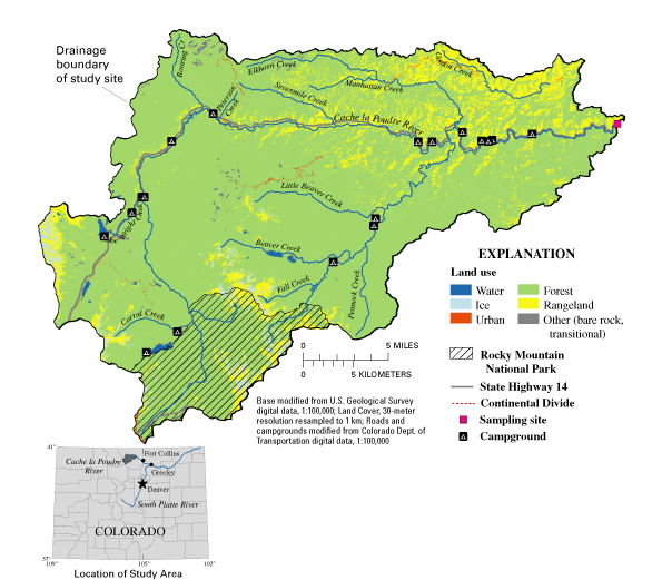
Figure 1. Map of the study area.
|
The Cache la Poudre River, Colorado, as a Drinking-Water Source By Jim A. Collins and Lori A. Sprague
Figure 1. Map of the study area. |
| AccessibilityFOIAPrivacyPolicies and Notices | |
 |
|