Fact Sheet 090–96
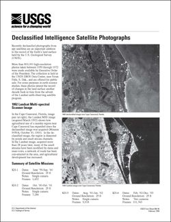
SummaryRecently declassified photographs from spy satellites are an important addition to the record of the Earth’s land surface held by the U.S. Geological Survey (USGS). More than 800,000 high-resolution photos taken between 1959 through 1972 were made available by Executive Order of the President. The collection is held at the USGS EROS Data Center, near Sioux Falls, S. Dak., and are offered for public sale. For some purposes in earth science studies, these photos extend the record of changes in the land surface another decade back in time from the advent of the Landsat earth-observing satellite program. |
First posted February 1998 Part or all of this report is presented in Portable Document Format (PDF); the latest version of Adobe Reader or similar software is required to view it. Download the latest version of Adobe Reader, free of charge. |
U.S. Geological Survey, 1996, Declassified intelligence satellite photographs: U.S. Geological Survey Fact Sheet 090–96, 2 p., available only online at https://pubs.usgs.gov/fs/1996/0090/.

![]() U.S. Department of the Interior |
U.S. Geological Survey
U.S. Department of the Interior |
U.S. Geological Survey
URL: http://
pubsdata.usgs.gov
/pubs/fs/1996/0090/index.html
Page Contact Information: USGS Publications Team
Page Last Modified: Tuesday, 29-Nov-2016 18:10:27 EST
