Fact Sheet 1997–041
Montgomery County Study| Samples Collected and Analyzed | Data Comparisons | An Active Role in Indiana
The USGS sampled streams in Montgomery County as part of a study done in cooperation with the Montgomery County Commissioners. The sampling program was designed by the Montgomery County Sanitarian and USGS hydrologists. The program focused on assessing general surface-water quality throughout the county and also targeted some specific areas of interest to county officials.
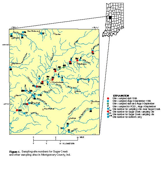
In April 1996, 12 sites were sampled on Sugar Creek (fig. 1, on back). Sugar Creek is the largest stream in the county and has long been enjoyed by canoeists and fishermen. During August 1996, the 12 Sugar Creek sites were resampled to examine seasonal variations in water quality. Samples were collected in August 1996 at 27 additional sites on streams that are tributary to Sugar Creek or drain significant areas of Montgomery County. The stream samples were analyzed for
In addition, samples of streambed sediment were collected and analyzed to address concerns about stream contamination with lead and polychlorinated biphenyls (PCB's) at sites where there was the greatest potential for occurrence.
The USGS and Montgomery County officials are planning to assemble historical water-quality data to identify potential trends in water quality. Improvements to local sewage-treatment plants and more stringent State and Federal regulations have been accompanied by industrial growth and changing land use in Montgomery County; these changes may be reflected in the water-quality data through time. The water-quality analyses from this study also may be used to identify locations where further sampling is needed.
The USGS has played an active role in water science in Indiana since 1903 by collecting objective hydrologic data and by providing resource managers with unbiased interpretive reports. In cooperation with the Indiana Department of Natural Resources, the USGS monitors 166 streamflow-gaging sites, 94 ground-water wells, and more than 80 lake and reservoir stations. The USGS assists other State and local agencies with state-of-the-art investigations of surface- and ground-water hydrology, lake systems, aquatic biology, and geomorphology.
The Indiana District Office of the USGS Water Resources Division is in Indianapolis. Information about historical and current water-resource studies in Indiana, real-time stream discharge data, and other water-related information are accessible through the USGS Indiana World Wide Web Home Page, at: http://in.water.usgs.gov.
The U.S. Geological Survey (USGS) works with city, county, state, and federal agencies to provide information for understanding water-resource issues. Montgomery County, Indiana, is actively studying its water resources by collecting water-quality information at selected stream sites and working with the USGS office in Indianapolis. This water-quality information can be used to identify variations in natural influences, like streambed geology; sources of contamination; and effects of urban, agricultural, and other land use. Water-quality data also indicate the suitability of water for various uses (such as recreation and irrigation) and the health of aquatic organisms that inhabit the streams.
Additional earth science information can be found by accessing the USGS "Home Page" at http://www.usgs.gov/
For more information on all USGS reports and products (including maps, images, and computerized data), call 1-888-ASK-USGS.
U.S. Geological Survey, 1997, Water quality of selected stream in Montgomery County, Indiana, 1996, U.S. Geological Survey Fact Sheet 1997–041, https://pubs.er.usgs.gov/publication/fs04197.

![]() U.S. Department of the Interior |
U.S. Geological Survey
U.S. Department of the Interior |
U.S. Geological Survey
URL: http://pubsdata.usgs.gov/pubs/fs/1997/0041/index.html
Page Contact Information: GS Pubs Web Contact
Page Last Modified: Thursday, 18-Apr-2019 10:48:37 EDT
