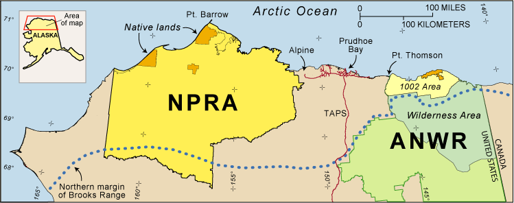
Figure 1. Map of northern Alaska showing locations and relative sizes of the National Petroleum Reserve in Alaska (NPRA) and the Arctic National Wildlife Refuge (ANWR). ANWR’s 1002 Area was evaluated for petroleum potential by the USGS in 1998. The Trans-Alaska Pipeline System (TAPS) and “feeder” pipelines extending east and west of Prudhoe Bay show the extent of existing petroleum infrastructure. Locations of the Alpine and Prudhoe Bay oil fields and the Point Thomson gas and oil accumulation also are shown.
Return to the NPRA Fact Sheet main page