|
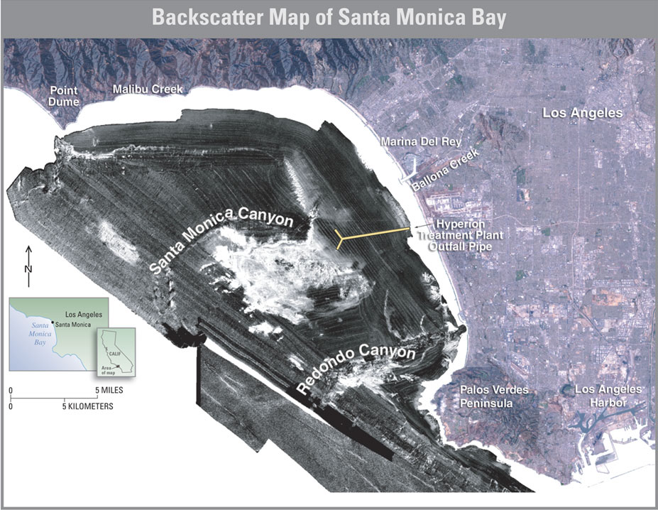
| This high-resolution image of Santa Monica Bay was created by U.S. Geological Survey scientists using multibeam acoustic mapping techniques. Multibeam data are collected by sending a sound signal toward the sea floor and receiving the reflected signal back at the source. The strength (backscatter) and timing of the reflected signal can then be used to map the topography and infer the geology of the sea floor. In this image, white areas represent a strong reflected signal and indicate harder materials such as rock, shell, and coarse sand. Dark areas indicate softer materials like mud and silt, which are finer grained and more easily transported. Such fine-grained sediments can readily bind with contaminants. |