DOWNLOAD the report [480-KB PDF file]
Download the lastest version of Adobe Reader for free |
|
The South Florida region is currently undergoing a massive restoration
effort guided by the Comprehensive Everglades Restoration Plan (CERP)
written
by a multi-agency group of Federal, State and local governments. One
of the primary goals of the CERP is to restore the quantity, quality,
and timing of freshwater delivery throughout South Florida to a more
natural state. The natural flow of freshwater in the South Florida
ecosystem was altered throughout the 20th century by the construction
of a series of canals and water-control structures. These systems affected
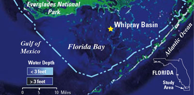
the estuaries of South Florida, including Florida Bay (located within
Everglades National Park), by altering the natural seasonal mixing of
fresh and saline waters. In addition, construction of the Flagler Railroad
and, later, U.S. Highway 1 through the Florida Keys restricted the exchange
of water between the Atlantic Ocean and Florida Bay. In order to establish
realistic goals and performance measures for restoration, it is essential
to first determine how the natural system functioned prior to significant
human alteration. The goal of this research is to develop a method to
identify historical patterns of salinity change throughout the bay, perhaps
at the seasonal scale, from the remains of animals preserved in shallow-water
sediment cores.
|

