U.S. GEOLOGICAL SURVEY
Fact Sheet 2005-3046—ONLINE ONLY
Sacramento, California 2005
Complete
accessible text of report (491 KB PDF)
To view PDF documents, you must have the Adobe Acrobat Reader (free
from Adobe Systems) installed on your computer.
(download free
copy of Acrobat Reader).
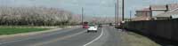
California is threatened by many natural hazards—fire, floods, landslides, earthquakes. The State is also threatened by longer-term problems, such as hydrologic effects of climate change, and human-induced problems, such as overuse of ground water and degradation of water quality. The threats and problems are intensified by increases in population, which has risen to nearly 36.8 million. For the USGS California Water Science Center, providing scientific information to help address hazards, threats, and hydrologic issues is a top priority. To meet the demands of a growing California, USGS scientific investigations are helping State and local governments improve emergency management, optimize resources, collect contaminant-source and -mobility information, and improve surface- and ground-water quality. USGS hydrologic studies and data collection throughout the State give water managers quantifiable and detailed scientific information that can be used to plan for development and to protect and more efficiently manage resources. The USGS, in cooperation with state, local, and tribal agencies, operates more than 500 instrument stations, which monitor streamflow, ground-water levels, and surface- and ground-water constituents to help protect water supplies and predict the threats of natural hazards. The following are some of the programs implemented by the USGS, in cooperation with other agencies, to obtain and analyze information needed to preserve California's environment and resources.
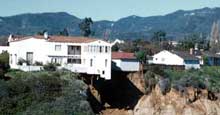 |
In 2004, the USGS California Water Science Center responded to potential dangers resulting from wild fires in southern California by rapidly deploying instruments to bolster the ALERT network and local agencies' debris-flow and hydrologic-hazard warning systems. By coordinating with local, state, and federal emergency-management operations, the USGS was able to issue timely debris-flow watches and warnings, and maps detailing areas of potential landslides.
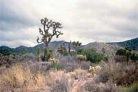 |
Water pumped from the Joshua Tree subbasin has been the sole source of water for the community of Joshua Tree in the southern Mojave Desert. To improve the long- term sustainability of this water supply, the USGS, in cooperation with the Joshua Basin Water District, defined the geohydrologic framework, determined the quantity and distribution of recharge, and developed a ground-water flow model that can be used to help manage the water resources of the region.
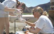 |
In cooperation with the State of California, the USGS has embarked on a comprehensive assessment of ground -water quality for the entire state. The Ground -Water Ambient Monitoring and Assessment (GAMA) program will provide information to resource managers to address issues ranging from local water-supply problems to statewide resource management.
 |
 |
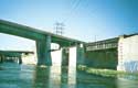 |
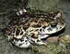
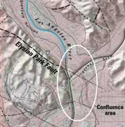
USGS scientists from three disciplines—geology, hydrology, and biology—collaborated to provide the Santa Monica Mountains Conservancy information on key scientific issues relevent to a proposed new park at the confluence of the Los Angeles River and the Arroyo Seco in Los Angeles. Information on faulting, earthquake ground motion, liquefaction, landsliding, hydraulics and water quality of surface and ground-water, wildlife colonization-extinction dynamics, wildlife corridors, wildlife reintroduction, non-native species, and potential restoration of local habitat and ecology was submitted to the Conservancy.
 |
 |
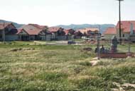
Cities such as Modesto in California's Central Valley have some of the highest
growth rates in the Nation, resulting in a gradual urbanization of adjacent
farmlands and an increased reliance on ground water. The USGS California Water
Science Center, in cooperation with the Modesto Irrigation District, compiled
nearly 3,500 driller's logs. USGS scientists are analyzing the logs to help
develop a detailed computer model of the ground-water system. The model will
be used to evaluate water-resources management
strategies and ensure adequate water supplies.
 |
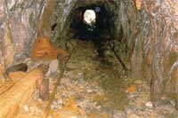 |
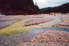
Mercury contamination from historical gold mines is a potential risk to human health and the environment. The USGS, in cooperation with local, state, and other federal agencies, is investigating mercury contamination in the Bear River and Yuba River watersheds. Data from the Bear-Yuba and from other USGS studies have been used by local and state agencies to issue fish consumption advisories for water bodies in northern California. USGS results have also been used by other federal agencies to prioritize mine sites for remediation.
 |
 |
Document Accessibility: Adobe Systems Incorporated has information about PDFs and the visually impaired. This information provides tools to help make PDF files accessible. These tools convert Adobe PDF documents into HTML or ASCII text, which then can be read by a number of common screen-reading programs that synthesize text as audible speech. In addition, an accessible version of Acrobat Reader 5.0 for Windows (English only), which contains support for screen readers, is available. These tools and the accessible reader may be obtained free from Adobe at Adobe Access.
| AccessibilityFOIAPrivacyPolicies and Notices | |
 |
|