Fact Sheet 2006-3027
U.S. GEOLOGICAL SURVEY
Fact Sheet 2006-3027
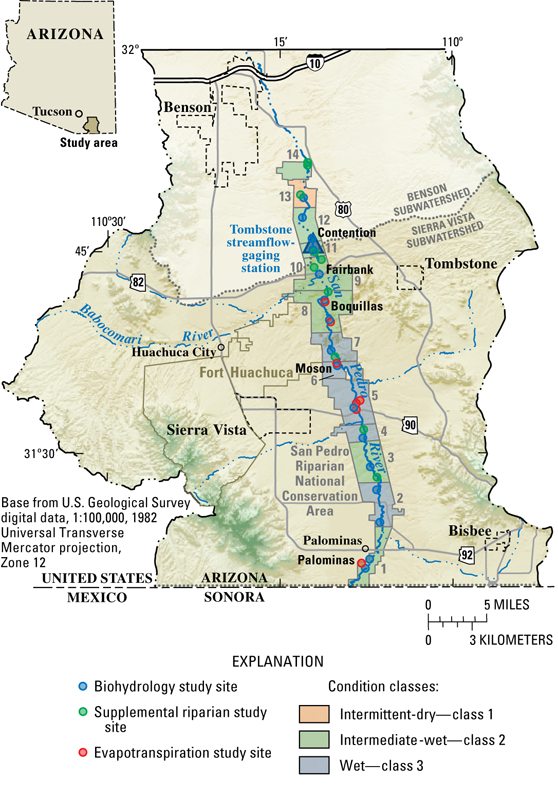
Figure 1. Boundaries of the Sierra Vista Subwatershed and locations of study sites and 14 reaches of the San Pedro River in the San Pedro Riparian National Conservation Area, Upper San Pedro Basin, Arizona.
For more information about USGS activities in Arizona, visit the USGS Arizona Water Science Center home page.

![]() U.S.
Department of the Interior | U.S. Geological
Survey
U.S.
Department of the Interior | U.S. Geological
Survey
Persistent URL: https://pubs.water.usgs.gov/fs20063055
Page Contact Information: Publications Team
Page Last Modified: Thursday, 25-May-2006 12:49:08 EDT