Fact Sheet 2006–3042

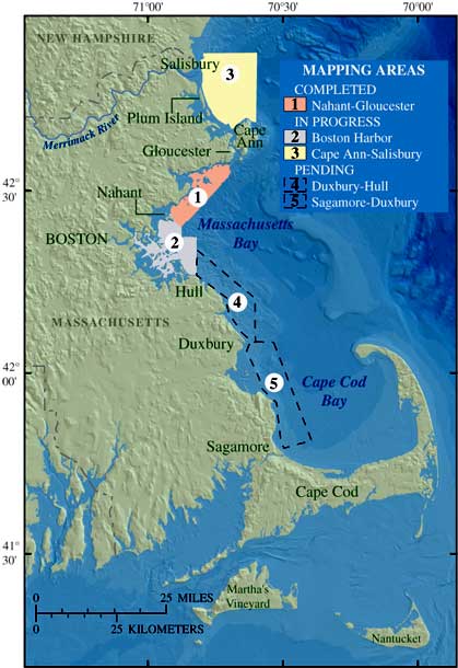
Figure 1. Map showing the five areas of seafloor mapping in Massachusetts.
A shaded relief map of the Massachusetts coast with 5 boxes that indicate where seafloor-mapping surveys are completed, in progress, and pending. Area 1 stretches from Nahant to Gloucester and is completed. Area 2 is Boston Harbor and is in progress. Area 3 stretches from Cape Ann to Salisbury and is in progress. Areas 4 and 5 stretch from Duxbury to Hull and Sagamore to Duxbury, respectively, and are pending.