Fact Sheet 2006–3054
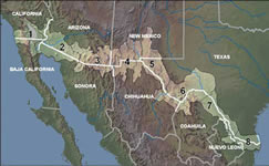 
The diverse, fragile ecosystems of the borderlands have been pushed beyond sustainable levels due to rapid population growth and land-use changes. Water shortages and pollution, poor air quality, increased soil salinities, residual pesticides and heavy metal contaminants are some of the many stressors that are degrading the quality of life in the borderlands. The relationship between human health and environmental quality challenges public officials, medical professionals, and resource managers on both sides of the border in their efforts to provide for and maintain healthy communities. To help understand the relationship between environmental and human health, the U.S. Geological Survey’s (USGS) Border Environmental Health Initiative (BEHI) created an Internet Map Service (IMS) with binational georeferenced data. The goal is to have seamless integration of borderwide datasets at regional and local scales that can lend understanding of the linkages between the condition of the physical environment and public health issues. Border Environmental Health Initiative http://borderhealth.cr.usgs.gov/ |
Version 1.0 Posted August 2006 (Supersedes FS 2004-3140)
|
Part or all of this report is presented in Portable Document Format (PDF); the latest version of Adobe Acrobat Reader or similar software is required to view it. Download the latest version of Acrobat Reader, free of charge or go to access.adobe.com for free tools that allow visually impaired users to read PDF files.
