Fact Sheet 2007-3100
 |
Select an option: |
|
CONTENTS Research Facilities and Vessels Research Tools and Capabilities Mapping Technology Sonar Systems Underwater Imaging Mapping with Airborne Sensors Cooperative Partnerships Contact Information |
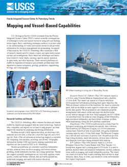
U.S. Geological Survey (USGS) scientists from the Florida Integrated Science Center (FISC) conduct scientific investigations of submerged coastal and marine resources using new and existing technologies. Each contributing technique, method, or product adds to our understanding of coastal and marine resources and provides information for resource-management decisionmaking. In support of this mission, the USGS St. Petersburg office maintains a fleet of research vessels used for inland, coastal, and open-water marine surveys and investigations. Each vessel has advantages and limitations related to water depth, carrying capacity, speed, operation in open water, and other functions. These research platforms are staffed by experienced technical and scientific professionals with expertise in marine navigation, geology, geophysics, engineering, biology, and oceanography.
Raabe, E.A., and Robbins, L.L., 2007, Mapping and Vessel-Based Capabilities: U.S. Geological Survey Fact Sheet 2007-3100, 4 p.
U.S. Geological Survey
Florida Integrated Science Center
U.S. Geological Survey
600 4th Street South
St. Petersburg, FL 33701
Jack Kindinger (jkindinger@usgs.gov) :: Terry Kelley (tkelley@usgs.gov)
(727-803-8747 x3002) (727-803-8747 x3050)
| Accessibility FOIA Privacy Policies and Notices | U.S. Department of the Interior, U.S. Geological Survey
Persistent URL: https://pubs.usgs.gov/fs/2007/3100 Page Contact Information: USGS Publishing Network Page Last Modified: Tuesday, 29-Nov-2016 18:07:57 EST |
 |