Fact Sheet 2009–3016
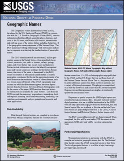
SummaryThe Geographic Names Information System (GNIS), developed by the U.S. Geological Survey (USGS) in cooperation with the U.S. Board on Geographic Names (BGN), contains information about the official names for places, features, and areas in the 50 States, the District of Columbia, the territories and outlying areas of the United States, including Antarctica. It is the geographic names component of The National Map. The BGN maintains working relationships with State names authorities to cooperate in achieving the standardization of geographic names. The GNIS contains records on more than 2 million geographic names in the United States—from populated places, schools, reservoirs, and parks to streams, valleys, springs, ridges, and every feature type except roads and highways. Entries include information such as the federally-recognized name and variant names and spellings for the feature; former names; the status of the name as determined by the BGN; county or counties in which each named feature is located; geographic coordinates that locate the approximate center of an aerial feature or the mouth and source of a linear feature, such as a stream; name of the cell of the USGS topographic map or maps on which the feature may appear; elevation figures derived from the National Elevation Dataset; bibliographic code for the source of the name; BGN decision dates and historical information are available for some features. Data from the GNIS are used for emergency preparedness, mapmaking, local and regional planning, service delivery routing, marketing, site selection, environmental analysis, genealogical research, and other applications. |
Revised May 2012 First Posted March 19, 2009 For additional information contact: Part or all of this report is presented in Portable Document Format (PDF); the latest version of Adobe Reader or similar software is required to view it. Download the latest version of Adobe Reader, free of charge. |
Yost, A.Y., Carswell, W.J. Jr., 2009, Geographic Names: U.S. Geological Survey Fact Sheet 2009-3016, 2 p.

![]() U.S. Department of the Interior | U.S. Geological Survey
U.S. Department of the Interior | U.S. Geological Survey
URL: http://pubsdata.usgs.gov/pubs/fs/2009/3016/index.html
Questions or Assistance: Contact USGS
Last modified: Tuesday, 29-Nov-2016 17:31:45 EST
