Fact Sheet 2009–3097
Introduction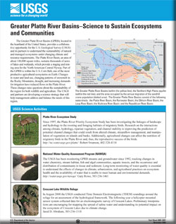
The Greater Platte River Basins (GPRB), located in the heartland of the United States, provides a collaborative opportunity for the U.S. Geological Survey (USGS) and its partners to understand the sustainability of natural and managed ecosystems under changing climate and resource requirements.The Greater Platte River Basins, an area of about 140,000 square miles, sustains thousands of acres of lakes and wetlands, which provide a staging and resting area for the North American Central Flyway. Part of the GPRB is within the U.S. Corn Belt, one of the most productive agricultural ecosystems on Earth. Changes in water and land use, changing patterns of snowmelt in the Rocky Mountains, drought, and increasing demands for irrigation have reduced flows in the Platte River. These changes raise questions about the sustainability of the region for both wildlife and agriculture.The USGS and partners are developing a science strategy that will help natural-resource managers address and balance the needs of this region. |
First posted November 17, 2009 For additional information contact: 303-236-1450 (telephone) Part or all of this report is presented in Portable Document Format (PDF); the latest version of Adobe Reader or similar software is required to view it. Download the latest version of Adobe Reader, free of charge. |
Thormodsgard, J.M., 2009, Greater Platte River Basins—Science to Sustain Ecosystems and Communities: U.S. Geological Survey Fact Sheet 2009–3097, 6 p.
Platte River Ecosystem Study
National Water-Quality Assessment Program (NAWQA)
Crescent Lake Wildlife Refuge
High Plains Groundwater Availability Study
Recharge Estimation Across the Central Platte River Basin
Microbial Water-Quality Effects from Lower Flows and Increased Migratory Bird Densities
Effects of Water and Channel Management on Stream Ecology of the Lower Platte River, 1934–2006
Magnetic Resonance Sounding (MRS) Data of the Central Platte River
Streamflow and Topographic Characteristics of the Platte River, 1938–2007
Trends in Streamflow Characteristics of Selected Sites in the Elkhorn River, Salt Creek, and Lower Platte River Basins, Eastern Nebraska, 1928–2004, and Evaluation of Streamflows in Relation to Instream-Flow Criteria, 1953–2004
Sand Dunes in the Greater Platte River Basin
Carbon Sequestration in the Greater Platte River Basin
Land Performance/Productivity Anomalies Mapped with Satellite Imagery
Headwaters Research and Monitoring of the Hydrologic Cycle
Loch Vale Watershed
Central Colorado Assessment Project
Surficial Geologic Mapping and Hydrogeologic Framework Studies
North American Soil Geochemical Landscapes Project
National Geochemical Database (NGDB)
Land Cover Trends
Hydrologic Flux Dynamics and Trends
Decline of Paper Birch Populations
Oil and Gas Production
Carbon Dioxide and Evapotranspiration in the South Platte Watershed
North Park – Medicine Bow Mountains Geology
Hydrogeologic Framework for Selected Areas of the Upper Loup River Basins
Evapotranspiration Rates of Riparian Forests
Resistivity Survey of Selected Irrigation Canals within the North Platte Valley
Heliborne Electromagnetic Surveys for Hydrologic Studies
Heliborne Geophysical Mapping of the Glaciated Areas of Eastern Nebraska

![]() U.S. Department of the Interior |
U.S. Geological Survey
U.S. Department of the Interior |
U.S. Geological Survey
URL: http://pubsdata.usgs.gov/pubs/fs/2009/3097/index.html
Page Contact Information: GS Pubs Web Contact
Page Last Modified: Tuesday, 29-Nov-2016 17:34:30 EST
