Fact Sheet 2010-3004
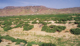
Human health so often depends on the health of the environment and wildlife around us. The presence of naturally occurring or human environmental contaminants and the emergence of diseases transferred between animals and humans are growing concerns worldwide. The USGS is a source of natural science information vital for understanding the quantity and quality of our earth and living resources. This information improves our understanding not only of how human activities affect environmental and ecological health, but also of how the quality of our environment and wildlife in turn affects human health. USGS is taking a leadership role in providing the natural science information needed by health researchers, policy makers, and the public to safeguard public health. Chemical and pathogenic contaminants affect our drinking and recreational waters, the air and dust we breathe, the soil we touch, and the food we eat. Expanding population centers and rapid growth in animal agriculture are increasing the contact between people and animals, both wildlife and domestic, thereby increasing the risk of transmission of new and resurging infectious diseases. All of these public health threats are affected by the inherent relationship between people and the physical, chemical, and biological character of their natural environment. An unprecedented globalization of public health issues has resulted from increases in commerce, travel, and the general mobility of the world population. Public health risks will likely increase with population growth, the associated pressures of development and habitat modification, and increasing globalization.
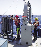
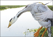
Opportunities for CoordinationThe USGS has helped protect human health by providing a wide range of scientific knowledge and information. Methods for rapid bacteriological monitoring and Internet-based models now allow beach goers to consider current beach health conditions before they leave home. Understanding the geochemical factors that affect the movement of arsenic in groundwater helps water managers and private well owners protect drinking water supplies. Knowing the factors that affect the spread of West Nile Virus (including host animals, vectors, and habitat changes) helps the public and health care managers take appropriate precautions against infection. Monitoring flight patterns of migratory birds infected with Highly Pathogenic Avian Influenza helps health professionals prepare for potential disease outbreaks. Characterizing environmental disturbances after environmental disasters, such as Hurricane Katrina, helps the public return safely to their homes. Core capabilities in ecology, wildlife disease, hydrologic science, environmental geochemistry, and geospatial analysis enable the USGS to be a significant partner in finding improved solutions to public health problems. Coordination with public health agencies at the National, State, and local levels is essential to ensure that (1) resources are lever-aged on the highest priority issues, (2) information is provided in a useable and timely manner, and (3) partnerships achieve practical solutions to long-term, public health problems, as well as problems that require a rapid response. Recent USGS Contributions to Public Health
Zoonotic Cutaneous Leishmaniasis (ZCL)—A USGS scientist joined a team at the Pasteur Institute in Tunis, Tunisia, studying the transmission and prevention of ZCL. This pathogen, common in parts of Africa, is transmitted by a sand fly carried by rodents. ZCL causes severe skin lesions that generally take months to heal and can leave disfiguring scars. Children are the primary victims of the disease, with thousands of cases per year reported in Tunisia.
Source of Mercury Identified in the North Pacific Ocean—Until recently, it was believed that the source of mercury in the open ocean was geologic, such as from deep-sea vents. A USGS scientist helped show that mercury from the atmosphere settles to ocean depths of 200 to 700 meters, where the decomposition of organic matter results in the conversion of mercury to methylmercury, a highly toxic form of mercury that can end up in ocean fish. This knowledge will help health managers minimize human exposure to mercury through marine fish consumption. Coal Aquifers and Kidney Disease—USGS researchers are exploring links between coal aquifers and the kidney disease Balkan Endemic Nephropathy (BEN). Dissolved organic material in the water supplies of Balkan villages where BEN is found is likely derived from local low-rank coal aquifers. This organic material, not found in waters of villages unaffected by BEN, is believed to decrease viability and induce cell death in human kidney cell lines. Scientists are studying links between kidney disease and coal aquifers used as drinking water supplies in the U.S.
Tracking Wild Birds and Avian Influenza—USGS wildlife experts employ satellite telemetry to track the movements of waterfowl in support of avian influenza surveillance programs. Waterfowl captured in December 2008 at the Mai Po Nature Reserve in Hong Kong and near Orissa, India were fitted with miniaturized global positioning system (GPS) transmitters. These transmitters allow scientists to relate bird locations and migratory pathways to the occurrence of avian influenza outbreaks, and to improve understanding of interactions between wild and domestic birds. Contaminants Detected in 20 Percent of U.S. Domestic Wells—More than 20 percent of 2,100 domestic wells sampled in 48 States contained at least one contaminant at levels of potential human health concern. Fifteen percent of Americans, about 43 million people, use drinking water from private wells. Because these wells are not regulated by the Federal Safe Drinking Water Act, they are not routinely monitored for water quality. The contaminants most frequently measured at levels of potential concern included radon and arsenic, both of which are derived mainly from natural rock materials that make up the aquifers from which the water is drawn. Manmade organic chemicals were detected in more than half of the sampled wells, but seldom at concentrations of human health concern. |
First posted January 28, 2010 For additional information: Part or all of this report is presented in Portable Document Format (PDF); the latest version of Adobe Reader or similar software is required to view it. Download the latest version of Adobe Reader, free of charge. |
Buxton, H.T., 2010, USGS Science Serves Public Health: U.S. Geological Survey Fact Sheet 2010-3004, 2 p.

![]() U.S. Department of the Interior |
U.S. Geological Survey
U.S. Department of the Interior |
U.S. Geological Survey
[an error occurred while processing this directive]
URL: https://pubsdata.usgs.gov
Page Contact Information: Contact USGS
Page Last Modified: Tuesday, 29-Nov-2016 17:37:55 EST