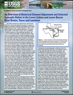
Fact Sheet 2010–3005
The Sabine and Brazos are alluvial rivers; alluvial rivers are dynamic systems that adjust their geometry in response to changes in streamflow (discharge) and sediment load. In fluvial geomorphology, the term “channel adjustment” refers to river channel changes in three geometric dimensions: (1) channel slope (profile); (2) the outline or shape, such as meandering or braided, projected on a horizontal plane (planform); and (3) cross-sectional form (shape). The primary objective of the study was to investigate how the channel morphology of these rivers has changed in response to reservoirs and other anthropogenic disturbances that have altered streamflow and sediment load. The results of this study are expected to aid ecological assessments in the lower Sabine River and lower Brazos River Basins for the Texas Instream Flow Program. Starting in the 1920s, several dams have been constructed on the Sabine and Brazos Rivers and their tributaries, and numerous bridges have been built and sometimes replaced multiple times, which have changed the natural flow regime and reduced or altered sediment loads downstream. Changes in channel geometry over time can reduce channel conveyance and thus streamflow, which can have adverse ecological effects. Channel attributes including cross-section form, channel slope, and planform change were evaluated to learn how each river’s morphology changed over many years in response to natural and anthropogenic disturbances. Climate has large influence on the hydrologic regimes of the lower Sabine and lower Brazos River Basins. Equally important as climate in controlling the hydrologic regime of the two river systems are numerous reservoirs that regulate downstream flow releases. The hydrologic regimes of the two rivers and their tributaries reflect the combined influences of climate, flow regulation, and drainage area. Historical and contemporary cross-sectional channel geometries at 15 streamflow-gaging stations in the lower Sabine and lower Brazos River Basins were evaluated. An in-depth discussion of results from streamflow-gaging station 08028500 Sabine River near Bon Weir, Tex., is featured here as an example of the analyses that were done at each station. |
First posted January 25, 2010 For additional information contact: Part or all of this report is presented in Portable Document Format (PDF); the latest version of Adobe Reader or similar software is required to view it. Download the latest version of Adobe Reader, free of charge. |
Heitmuller, F.T., Greene, L.E., and Gordon, J.D., 2010, An overview of historical channel adjustment and selected hydraulic values in the lower Sabine and lower Brazos River Basins, Texas and Louisiana: U.S. Geological Survey Fact Sheet 2010–3005, 4 p.
Use of Historical Cross Sections from USGS Streamflow Measurement Data to Evaluate Channel Adjustments
Alternative Techniques and Additional Sources of Data for Interpreting Channel Adjustment
08028500 Sabine River near Bon Weir, Texas
Reference

![]() U.S. Department of the Interior |
U.S. Geological Survey
U.S. Department of the Interior |
U.S. Geological Survey
URL: http://pubsdata.usgs.gov/pubs/fs/2010/3005/index.html
Page Contact Information: GS Pubs Web Contact
Page Last Modified: Tuesday, 29-Nov-2016 17:37:14 EST
