Fact Sheet 2012–3137
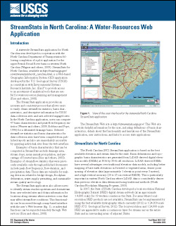
INTRODUCTIONA statewide StreamStats application for North Carolina was developed in cooperation with the North Carolina Department of Transportation following completion of a pilot application for the upper French Broad River basin in western North Carolina (Wagner and others, 2009). StreamStats for North Carolina, available at http://water.usgs.gov/osw/streamstats/north_carolina.html, is a Web-based Geographic Information System (GIS) application developed by the U.S. Geological Survey (USGS) in consultation with Environmental Systems Research Institute, Inc. (Esri) to provide access to an assortment of analytical tools that are useful for water-resources planning and management (Ries and others, 2008). The StreamStats application provides an accurate and consistent process that allows users to easily obtain streamflow statistics, basin characteristics, and descriptive information for USGS data-collection sites and user-selected ungaged sites. In the North Carolina application, users can compute 47 basin characteristics and peak-flow frequency statistics (Weaver and others, 2009; Robbins and Pope, 1996) for a delineated drainage basin. Selected streamflow statistics and basin characteristics for data-collection sites have been compiled from published reports and also are immediately accessible by querying individual sites from the web interface. Examples of basin characteristics that can be computed in StreamStats include drainage area, stream slope, mean annual precipitation, and percentage of forested area (Ries and others, 2008). Examples of streamflow statistics that were previously available only through published documents include peak-flow frequency, flow-duration, and precipitation data. These data are valuable for making decisions related to bridge design, floodplain delineation, water-supply permitting, and sustainable stream quality and ecology. The StreamStats application also allows users to identify stream reaches upstream and downstream from user-selected sites and obtain information for locations along streams where activities occur that may affect streamflow conditions. This functionality can be accessed through a map-based interface with the user’s Web browser, or individual functions can be requested remotely through Web services (Ries and others, 2008). |
First posted December 20, 2012
For additional information contact: Part or all of this report is presented in Portable Document Format (PDF); the latest version of Adobe Reader or similar software is required to view it. Download the latest version of Adobe Reader, free of charge. |
Weaver, J.C., Terziotti, Silvia, Kolb, K.R., and Wagner, C.R., 2012, StreamStats in North Carolina: A water-resources Web application: U.S. Geological Survey Fact Sheet 2012–3137, 4 p., available at https://pubs.usgs.gov/fs/2012/3137/.

![]() U.S. Department of the Interior |
U.S. Geological Survey
U.S. Department of the Interior |
U.S. Geological Survey
URL: http://pubsdata.usgs.gov/pubs/fs/2012/3137/index.html
Page Contact Information: GS Pubs Web Contact
Page Last Modified: Tuesday, 29-Nov-2016 18:33:09 EST
