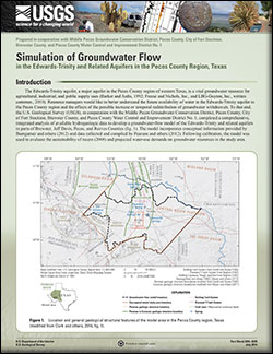
Fact Sheet 2014–3029
|
First posted August 5, 2014 For additional information, contact: Part or all of this report is presented in Portable Document Format (PDF). For best results viewing and printing PDF documents, it is recommended that you download the documents to your computer and open them with Adobe Reader. PDF documents opened from your browser may not display or print as intended. Download the latest version of Adobe Reader, free of charge. More information about viewing, downloading, and printing report files can be found here. |
Thomas, J.V., 2014, Simulation of groundwater flow in the Edwards-Trinity and related aquifers in the Pecos County region, Texas: U.S. Geological Survey Fact Sheet 2014–3029, 6 p., https://dx.doi.org/10.3133/fs20143029.
ISSN 2327-6916 (print)
ISSN 2327-6932 (online)
Introduction
Description of the Model Area
Groundwater-Flow Model Construction
Model Calibration Results
Model Limitations
Development of Groundwater-Pumping Scenarios
References Cited

![]() U.S. Department of the Interior |
U.S. Geological Survey
U.S. Department of the Interior |
U.S. Geological Survey
URL: http://pubsdata.usgs.gov/pubs/fs/2014/3029/index.html
Page Contact Information: GS Pubs Web Contact
Page Last Modified: Tuesday, 29-Nov-2016 17:25:48 EST