Fact Sheet 2015–3063
What Is the Columbia Plateau?The Columbia Plateau is a wide basalt plateau between the Cascade Range and the Rocky Mountains that covers parts of Washington, Oregon, and Idaho (fig. 1). The climate over much of the Columbia Plateau is semiarid with precipitation ranging from 7 to 15 in/yr in the central part (Vaccaro and others, 2015), yet the area supports a $6 billion per year agricultural industry, including the production of apples, corn, grapes, hops, mint, potatoes, stone fruit, and wheat. Groundwater pumpage and surface-water diversions supply water to irrigated croplands that account for about 5 percent of the Nation’s irrigated lands. Groundwater also is the primary source of drinking water for about 1.3 million people living on the plateau. 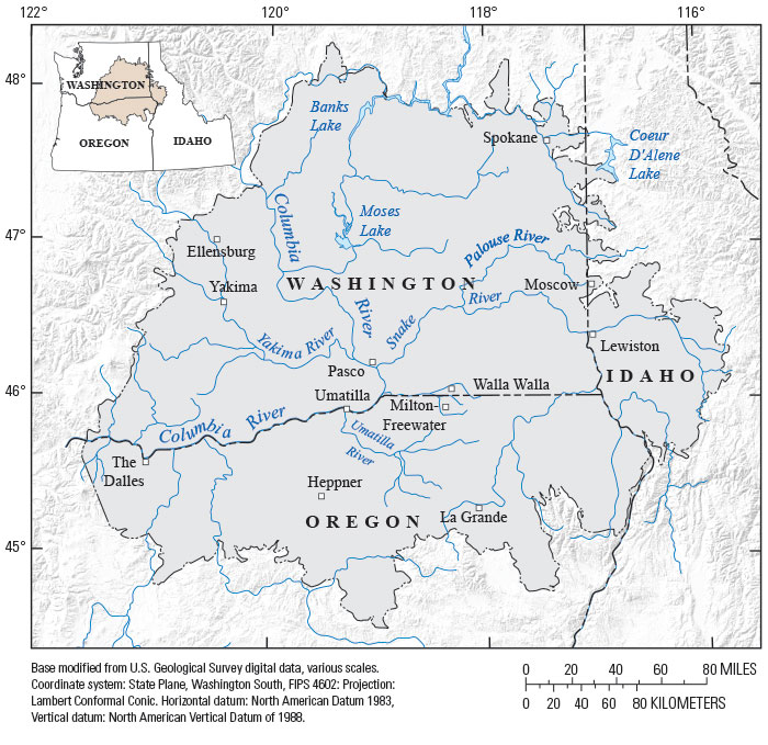
Figure 1. Columbia Plateau Regional Aquifer System study area, Washington, Oregon, and Idaho. What Is the USGS Columbia Plateau Groundwater Availability Study?The U.S. Geological Survey (USGS) conducts large-scale multidisciplinary regional studies of groundwater availability, such as this study of the Columbia Plateau Regional Aquifer System (CPRAS). This study provides citizens, communities, and natural resource managers with (1) improved information and knowledge of the status of the groundwater resources, (2) information about how the resources have changed over time, and (3) tools to forecast how the resources may change in the future. 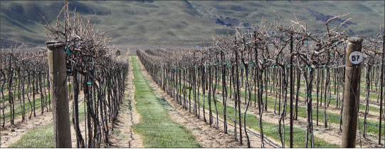
Vineyard looking (south) toward Horse Heaven Hills, Washington. Photograph by Carmen Lee, 2011. What Is the Columbia Plateau Regional Aquifer System?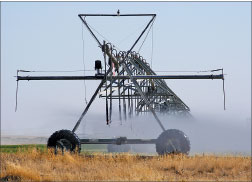
Pivot irrigator, northeastern Washington. Photograph by David Beedon, 2003. The CPRAS covers an area of about 44,000 square miles within the drainage of the Columbia River. The primary aquifers within the Columbia Plateau occur in basalts of the Columbia River Basalt Group (CRBG) and in places, overlying sediment. The CRBG consists of a series of lava flows that erupted from fissures and vents along the Washington/Oregon/Idaho border during the Miocene Age, 17 million to 6 million years ago. More than 350 flows have been identified and individual flows range in thickness from 10 to more than 300 feet; interbeds occur in places where sediment accumulated between flows. 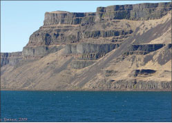
Basalt bluffs at Wallula Gap, Washington. Photograph by Lyn Topinka, U.S. Geological Survey, 2005. Groundwater levels have declined over more than 10,000 square miles (about 23 percent of the CPRAS) due to pumping at rates that exceed groundwater recharge. Areas with large and widespread declines are located in the central northern part of the study area (referred to as the Odessa Subarea), in parts of the Yakima River basin in Washington, in the Pullman-Moscow area in Washington and Idaho, and in parts of the Umatilla River basin in Oregon. These declines are in areas known to rely heavily on groundwater for irrigation and other uses. In contrast, about 5 percent of the CPRAS has experienced groundwater level rises due to the delivery and application of surface water for irrigation within the large Bureau of Reclamation irrigation projects (fig. 2). 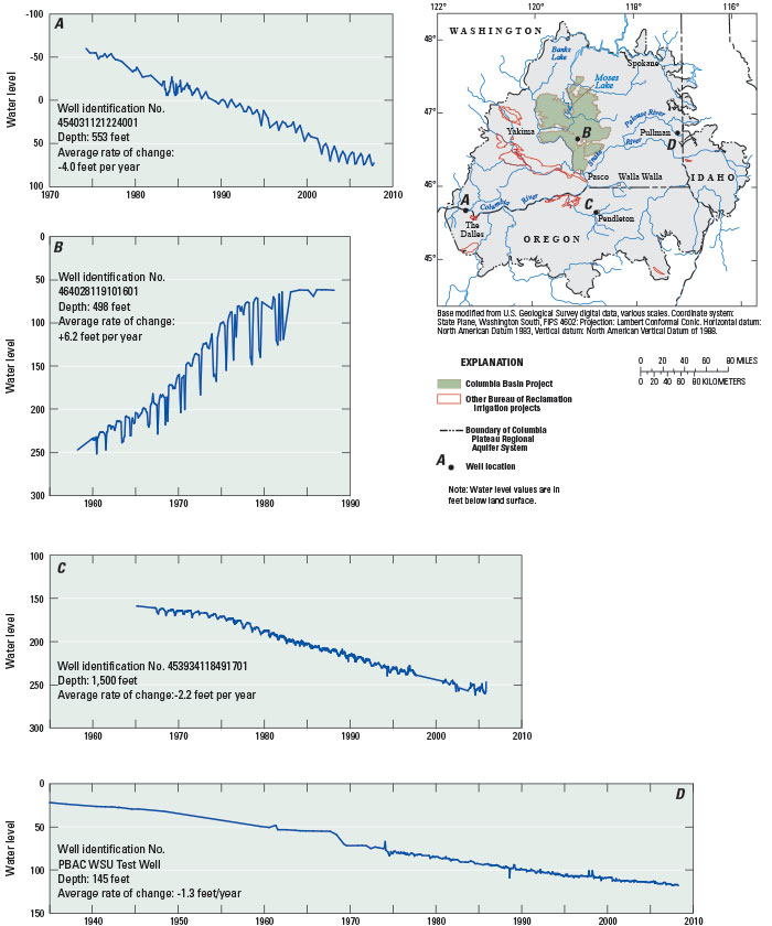
Figure 2. Long-term water level changes in selected wells, Columbia Plateau Regional Aquifer System, Washington, Oregon, and Idaho. All hydrographs are at same scale. (Modified from Snyder and Haynes, 2010.) What Kinds of Scientific Information Were Collected and Analyzed?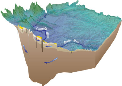
3-dimensional diagram of the Columbia Plateau Regional Aquifer System looking northeast, not to scale. Surface topography shown in blues and greens; subsurface basalt units shown in browns; approximate groundwater-flow directions indicated by arrows. Many types of information were collected and analyzed as part of the CPRAS Study, some highlights are:
What Is the Groundwater-Flow Model of the System?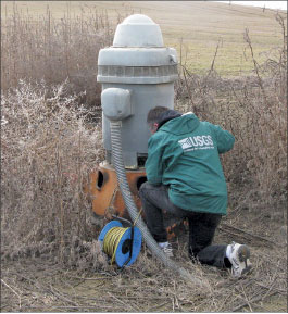
USGS hydrologic technician measuring the water level in a well near Yakima. Photograph by Karen Payne, U.S. Geological Survey, March 2009. A major product of this assessment is a numerical groundwater-flow model of the CPRAS (Ely and others, 2014). A groundwater-flow model is a mathematical representation of groundwater flow through an aquifer system that uses information about aquifer properties, groundwater recharge, discharge, and groundwater levels, as well as physical processes governing groundwater flow. Models are useful tools for investigating variations in water supply, water demand, management strategies, groundwater/surface-water exchanges, and potential effects of changing climate on a hydrologic system. The CPRAS model domain was subdivided into a horizontal grid of 126 rows and 131 columns using a uniform 3-kilometer (9,842-feet) grid. Each of the five hydrogeologic units represented in the model was subdivided into approximately 100-foot-thick layers, yielding 100 model layers. The detailed vertical discretization improved the understanding of the important vertical flow component in the CPRAS. The model was used to estimate annual water budgets for the system, flow between hydrogeologic units, changes in the system from predevelopment conditions, likely changes in the system if the conditions in 2007 existed through 2050, and potential effects in 2050 of increased irrigation demand owing to climate warming. The model results show the potential usefulness of this tool in providing information for short- to long-term management planning and decisions by numerous stakeholders. 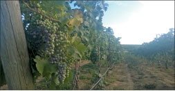
Wine grapes near George, Washington. Photograph by Pearl Kahle, 2015. Among the important findings of this new groundwater-flow model of the CPRAS are:
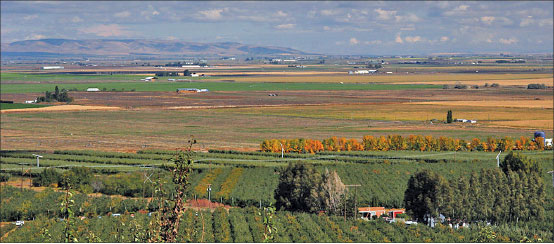
Agriculture in the Quincy Valley. Photograph by David Putnam, July 2006. What Are the Key Points Regarding Water Resources?
Fuji apples east of Moses Lake, Washington. Photograph by Sue Kahle, 2015. Groundwater availability is critical to managing water resources in the CPRAS because of the high water demand for agriculture, economic development, and ecological needs and the great competition for the limited resource. Water-resource issues that have implications for future groundwater availability include:
Ongoing activities in the region for enhancement of fisheries and obtaining additional water for agricultural, municipal, and domestic use may be affected by groundwater withdrawals and rules implemented under the Endangered Species Act for numerous stocks of salmonids. The study addressed some of these groundwater availability issues by improving the understanding of the hydrogeologic system, the status and trends of the groundwater system, the general relation between groundwater and surface waters, current water use, and the water budget for the CPRAS. 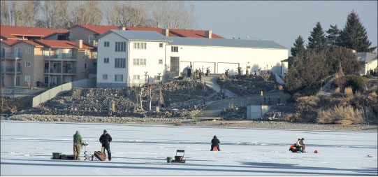
Ice fishing on Moses Lake, Washington. Photograph by Karen Payne, U.S. Geological Survey, 2011. Additional InformationThis USGS Fact Sheet is a brief summary of USGS Professional Paper 1817, “Groundwater availability of the Columbia Plateau Regional Aquifer System, Washington, Oregon, and Idaho” by J.J. Vaccaro, S.C. Kahle, D.M. Ely, E.R. Burns, D.T. Snyder, J.V. Haynes, T.D. Olsen, W.B. Welch, and D.S. Morgan. For additional information regarding this study, readers are referred to the Professional Paper for more in-depth descriptions of the CPRAS study and results of the investigation. References CitedBurns, E.R., Morgan, D.S., Peavler, R.S., and Kahle, S.C., 2011, Three-dimensional model of the geologic framework for the Columbia Plateau Regional Aquifer System, Idaho, Oregon, and Washington: U.S. Geological Survey Scientific Investigations Report 2010-5246, 44 p., accessed March 1, 2011, at https://pubs.usgs.gov/sir/2010/5246/. Ely, D.M., Burns, E.R., Morgan, D.S., and Vaccaro, J.J., 2014, Numerical simulation of groundwater flow in the Columbia Plateau Regional Aquifer System, Idaho, Oregon, and Washington: U.S. Geological Survey Scientific Investigations Report 2014-5127, 90 p., https://dx.doi.org/10.3133/sir20145127. Kahle, S.C., Morgan, D.S., and Welch, W.B., 2011, Hydrogeologic framework and hydrologic budget components of the Columbia Plateau Regional Aquifer System, Washington, Oregon, and Idaho: U.S. Geological Survey Scientific Investigations Report 2011-5124, 66 p., accessed August 26, 2011, at https://pubs.usgs.gov/sir/2011/5124/. Senay, G.B., Budde, M.E., Verdin, J.P., and Melesse, A.M., 2007, A coupled remote sensing and simplified surface energy balance approach to estimate actual evapotranspiration from irrigated fields: Sensors, v. 7, p. 979–1,000. Senay, G.B, Verdin, J.P., Lietzow, R., and Melesse, A.M., 2008, Global reference evapotranspiration modeling and evaluation: Journal of American Water Resources Association, v. 44, no. 4, p. 969–979. Snyder, D.T., and Haynes, J.V., 2010, Groundwater conditions during 2009 and changes in groundwater levels from 1984 to 2009, Columbia Plateau Regional Aquifer System, Washington, Oregon, and Idaho: U.S. Geological Survey Scientific Investigations Report 2010-5040, 12 p., accessed October 27, 2010, at https://pubs.usgs.gov/sir/2010/5040/. Vaccaro, J.J., Kahle, S.C., Ely, D.M., Burns, E.R., Snyder, D.T., Haynes, J.V., Olsen, T.D., Welch, W.B., and Morgan, D.S., 2015, Groundwater availability of the Columbia Plateau Regional Aquifer System, Washington, Oregon, and Idaho: U.S. Geological Survey Professional Paper 1817, 87 p., https://dx.doi.org/10.3133/pp1817. |
First posted September 22, 2015 For additional information, contact: Project web page at: http://wa.water.usgs.gov/projects/cpgw/ Part or all of this report is presented in Portable Document Format (PDF). For best results viewing and printing PDF documents, it is recommended that you download the documents to your computer and open them with Adobe Reader. PDF documents opened from your browser may not display or print as intended. Download the latest version of Adobe Reader, free of charge. More information about viewing, downloading, and printing report files can be found here. |
Kahle, S.C., and Vaccaro, J.J., 2015, Groundwater resources of the Columbia Plateau Regional Aquifer System: U.S. Geological Survey Fact Sheet 2015-3063, 6 p., https://dx.doi.org/10.3133/fs20153063.
ISSN 2327-6932 (online)
ISSN 2327-6916 (print)

![]() U.S. Department of the Interior |
U.S. Geological Survey
U.S. Department of the Interior |
U.S. Geological Survey
URL: http://pubsdata.usgs.gov/pubs/fs/2015/3063/index.html
Page Contact Information: GS Pubs Web Contact
Page Last Modified: Tuesday, 29-Nov-2016 18:34:57 EST
