|
|
The safety, health, and economic well being of Illinois' citizens are
important to the U.S. Geological Survey (USGS). The USGS is involved in
the study of water, mineral, and biological resources throughout the State,
Through cooperative programs with many Federal, State, and local agencies,
the USGS is at work every day in the State of Illinois studying coastal
erosion, assessing water quality, and determining the risk from
earthquakes, landslides, and other natural hazards. Through national
programs, citizens of Illinois also have access to the thousands of map,
book, and aerial photographic products of the USGS. Information follows on
acquiring these products and accessing various traditional and electronic
sources of products and services. |

|
|
During this century, water levels in Lake Michigan have risen successively
higher. The highest water levels ever recorded were from 1985 to 1987.
Periodic intense storm waves, as well as high water levels, cause damage to
the Illinois shoreline. This was especially true in 1986 when storm waves
and high lake levels caused extensive damage to Chicago Lakefront
businesses, parks, and condominiums. The potential savings of millions of
dollars in beach replenishment and maintenance costs was the goal of
studies by the Illinois Department of Natural ResourcesĐIllinois State
Geological Survey (ISGS), several Illinois universities, the U.S. Army
Corps of Engineers (USACE), and the National Oceanic and Atmospheric
Administration.
The USGS cooperated in studies to determine why and where the structures
that support the shoreline are failing and why and where the sand, which
normally protects the shoreline and maintains the beaches, is being
depleted. A major finding is that prehistoric lake-level fluctuations were
at least twice as great as those observed historically. |
The USGS study of the Chicago shoreline protection structures serves as a
basis for planning extensive reconstruction. Understanding sand movement
by mapping lake-bottom physiography and sediment distribution by using
sidescan sonar imagery and seismic reflection geophysical techniques (fig. 1). Together, these data provide the
basis for preparing lake-bottom maps of physiography and sediment
distribution and can enable planners to save millions of dollars in beach
replenishment and maintenance costs.

(Click on image for a larger version, 50K GIF)
|
|
Figure 1. Southern Lake Michigan showing areas surveyed
by using sidescan sonar imagery and seismic reflection track lines. | |
|
Rapid urbanization of drainage areas has often led to unanticipated high
peak flows and increased frequency of flooding within or downstream from
the drainage areas. Computer models that represent the characteristics and
responses of watershed runoff in response to rainfall are used to apply
storm data to the planning, design, and management of roads, bridges,
culverts, and dams. Solutions developed by water-resource planners for
mitigating anticipated storm runoff can then be included in zoning
restrictions and construction plans for future development in areas that
are undergoing rapid urbanization. Rainfall and streamflow data are being
collected in suburban counties of Metropolitan Chicago that are undergoing
rapid development. These data are used to calibrate models of rainfall and
stream runoff to a variety of watershed conditions. Concurrently, a
real-time rainfall data network is being installed in a large watershed in
Du Page County. The information provided by the modeling study and the
network will be used to optimize the management of reservoir operations to
mitigate the severity of flooding. Cooperators on these studies are the Du
Page County Department of Environmental Concerns, the Lake County
Stormwater Management Commission, and the Illinois Department of Natural
Resources-Office of Water Resources. |
|
|
|
The availability of environmentally acceptable and reliable energy
resources is an important issue for Federal, State and local planners and
industries that utilize coal. Coal usage currently accounts for one-third
of the total energy used and more than one-half of the electricity
generated in the United States. Illinois has the largest resource of
bituminous coal in the United States. A cooperative program between the
USGS and the ISGS was initiated in 1992 to study 7.5-minute quadrangle
topographic maps of representative coal areas under development in the
State to identify current major constraints to the development of coal
resources and to estimate the amount of remaining coal resources that may
be available for development. As part of the coal assessment activities in
the Illinois Basin, the USGS is working with the ISGS to update data bases
for Illinois coals, and then to integrate these data bases with those from
other Illinois Basin States (Kentucky and Indiana).
|
Coal production in the Illinois Basin has declined over the last 2 to 3
years. This is because the electric utilities have switched from
high-sulfur coals from the Illinois Basin to low-sulfur coals from Western
States. The ISGS and USGS are cooperating in studies to develop models to
increase understanding of the geochemical processes that affect
distributions, variability, and modes of occurrences for sulfur and
potentially hazardous trace elements in coal. |
|
Illinois has a long history of exploration for and production of oil and
gas. Most of the State has been explored thoroughly for oil and gas, yet
there are areas that are underexplored because the oil and gas resources
are at great depths in the Illinois Basin. A technique known as the
mass-balance method has been developed to estimate the undiscovered amount
of oil and gas that the Basin could produce and how much has actually been
produced. As part of the National Oil and Gas Assessment, the USGS worked
with the ISGS to define oil and gas activities in the State. |
|
|
|
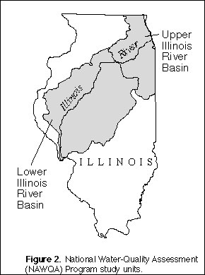
Protecting the quality of the Nation's ground- and surface-water resources
is a priority concern. The impact of degraded water quality may have
short- or long-term effects on public health or economic success. Project
scientists in the USGS National Water-Quality Assessment (NAWQA) Program
are collecting water-quality data in the lower Illinois River Basin and
have completed a study of the upper Illinois River Basin (fig. 2). The identification of the trends in water
quality is a major thrust of the NAWQA Program. Objectives of the lower
Illinois River Basin study are to provide a description of present
water-quality conditions; to develop conceptual models that relate observed
conditions to sources and causes; to track long-term trends in water
quality; and to improve the understanding of the relation between causative
factors and water quality. The NAWQA Program studies in Illinois have
established liaison committees with representatives from Federal, State,
and local agencies, such as the USACE, the Biological Resources Division
(BRD; formerly the National Biological Service), and the Metropolitan Water
Reclamation District of Greater Chicago to identify the important topics
for study. |

(Click on image for a larger version, 50K GIF)
|
|
Figure 2. National Water-Quality Assessment (NAWQA)
Program study units. |
|
|
In the past decade, there has been increasing awareness that the seismic
hazard in the Midwest may be greater than the historical earthquake record
would suggest. Recent discoveries have shown evidence of possibly eight or
more strong earthquakes (likely magnitudes between 6.0 and 7.5). At least
155 magnitude 2.5 or larger earthquakes have struck Illinois since 1875.
Numerous prehistoric earthquakes of magnitude 6 to 7 have struck southern
Indiana and Illinois; some may have been larger. Geologic evidence for
these earthquakes in the form of sand-and-gravel intrusions in river
sediments has been discovered at more than 200 sites in the Wabash River
Valley and along its tributaries in Illinois. This information is the
result of USGS studies done in cooperation with the Illinois Department of
Natural Resources-Illinois State Museum and the ISGS, the Indiana
Geological Survey, and Indiana University. |
|
|
|
Contamination of surface water and ground water by hazardous wastes is of
major concern throughout Illinois. Studies to characterize several
Superfund sites and urban areas in northern Illinois are being conducted by
the USGS in cooperation with the U.S. Environmental Protection Agency
(USEPA), Region V. The USGS is contributing technical expertise, such as
borehole logging, aquifer-test analysis, and water-quality sampling and
analysis, to aid in understanding the geologic and hydrologic
characteristics of the study areas. Results of these studies improve
understanding of the concentration and distribution of soil and
ground-water contamination needed for site remediation and protection of
ground-water supplies.
|
The USGS also is contributing technical expertise to studies at
hazardous-waste sites at several U.S. Department of Defense installations.
For example, the USGS is conducting a study of soil and ground-water
contamination at Fort Sheridan north of Chicago. Many of the military
installations in Illinois have been closed or are being closed under the
auspices of the Base Closure and Realignment Act, as part of the closure
procedures, and the problems of environmental contamination have to be
addressed. |
|
|
|
Since 1900, Illinois has diverted water from Lake Michigan down the Chicago
Sanitary and Ship Canal (CSSC; the Chicago River and associated waterways)
to the Des Plaines River and then to the Illinois River. This was done to
protect the quality of water in Lake Michigan by carrying sanitary
wastewater away from the Lake and allowing barge traffic on the Illinois
River between the Mississippi River and Chicago. The most recent U.S.
Supreme Court decision (1967 and modified December 1, 1980) that regulates
the diversion of water from Lake Michigan limits diversion by the State to
a 40-year average of 3,200 cubic feet per second. The USACE is responsible
for accounting for the water diverted, and the State is responsible for
allocation of the water diverted.
Determining the diversion by Illinois is a complicated and time-consuming
process. The USACE has determined that Illinois has diverted flows in
excess of the 3,200-cubic-feet-per-second limit from the 1983 to 1993 water
years. Improved accounting of the various components of the water
diversion is a goal of the diversion accounting program of the USACE. An
acoustic velocity meter (AVM) for measuring flows on the CSSC at Romeoville
is a key part of the Lake Michigan diversion accounting procedure. The
USGS is responsible for the operation and maintenance of the AVM by
agreement with the USACE.
|
The USGS also is cooperating with the USACE, the Illinois Department of
Natural ResourcesĐOffice of Water Resources, and the Metropolitan Water
Reclamation District of Greater Chicago to refine various components of the
Lake Michigan diversion accounting. The USGS also is applying advanced
techniques and technology, such as Acoustic Doppler current profilers and
AVM's, to measure flows in the CSSC and leakage through the lakefront
diversion-control structures. Recent measurements made by the USGS
indicate that actual leakage through the lakefront diversion-control
structures is much greater than previous estimates. |
|
Sedimentation in river basins throughout Illinois has resulted in reduced
depths of navigation pools and backwater lakes. Fish and migratory bird
populations are being adversely affected by a loss of food and habitat as a
result of increased sediment loads in the water and sediment deposits in
the aquatic habitats. The USGS is studying sedimentation on the
Mississippi, the Illinois, the Kankakee, and the Cache Rivers and other
streams to measure sediment loads. Measures of sediment concentrations and
loads are being made by the USGS in the pool above Lock & Dam 13 on the
Mississippi River and in the pool above La Grange Lock & Dam on the
Illinois River to determine sediment budgets and transport. The
sedimentation studies are being conducted in cooperation with the BRD, the
USACE, as well as State and local agencies. The USGS maintains a network
of 21 sediment-monitoring stations throughout the State in support of the
sedimentation studies and for basic data collection. |
|
|
|
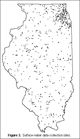
Surface- and ground-water and water-quality information are needed for a
variety of activities. These include the surveillance, planning, design,
hazard warning, operation, and management in water-related activities, such
as water supply, hydroelectric power generation, flood-control, irrigation,
bridge and culvert design, wildlife management, pollution abatement,
flood-plain management, and water-resources development. The USGS, in
cooperation with more than 20 Federal, State, and local agencies, collects
streamflow (fig. 3), ground-water level, and
water-quality data throughout the State.

(Click on image for a larger version, 50K GIF)
|
|
Figure 3. Surface-water data-collection sites. | |
Of the streamflow-gaging stations in Illinois, 146 (about 94 percent of all
stations) are equipped with satellite or telephone telemetry. Through a
network of satellite or telephone telemetry, streamflow data in Illinois
are provided to the National Weather Service, the USACE, and various other
Federal, State, and local agencies to manage flood-control structures and
reservoirs, to plan for flood mitigation, to forecast streamflow, and many
other activities. The public can find much of this information by
accessing the USGS home page computer on the World Wide Web at the USGS
District Office In Urbana at URL:
http://wwwdilurb.er.usgs.gov/ |
|
According to a 1985 inventory of landslides in Illinois, at least $8
million in damages have been documented since 1928. The USGS and the ISGS
continue to compile landslide information. The compiled data show that
most landslides in the State have been induced by construction activities
and that most occur along the Illinois and the Mississippi Rivers. In
spring 1995, heavy rain caused many damaging slides, in which one person
died. An inventory map of locations of severe landslide problems is useful
to developers, businesses, and local governmental agencies responsible for
developing mitigation strategies. Analyses of eight landslides within the
New Madrid Seismic Zone indicated that the landslides were stable, but
failure is possible during an earthquake of the magnitude experienced in
1812 (probably the strongest historic earthquake in the conterminous United
States). |
|
The USGS has had an on-going cooperative geologic mapping program with the
ISGS for the last 10 years to produce large-scale (1 inch equals 2,000
feet) geologic maps on the 7.5-minute quadrangle base. Priorities for
selection of areas to be mapped are set by the Illinois Geological Mapping
Advisory Committee, which consists of representatives from State and county
governments, universities, industry, professional associations, and others
concerned with geologic mapping. Geologic mapping is used in the
identification of mineral resources and delineation of glacial deposits for
determining sand and gravel resources and in the identification and
protection of aquifers susceptible to contamination. These programs also
include structural studies in selected parts of southern Illinois to assess
the age, character, and extent of faulting in areas within or near the New
Madrid Seismic Zone to help determine the earthquake-hazard potential. |
|
|
|
The USGS, in cooperation with Federal, State, and county governmental
agencies in Illinois, prepares printed topographic maps and computerized
geographic and cartographic data. The resulting products serve many
geographic information systems (GIS) applications in addressing natural
resource, conservation, waste disposal, emergency, hazard, and other
environmental and societal issues that confront the State's citizens.
Current USGS mapping work, much of it conducted in funding partnerships
with various agencies in Illinois, includes production of 1:100,000-scale
topographic maps and several types of computer-readable cartographic data,
which include ground-elevation and contour files, on-screen images of
topographic maps and aerial photographs, digital elevation models, and
map-revision data. A new set of aerial photographs also is being acquired
across the State through a cooperative effort.
State agencies currently participating with the USGS in the joint
production of digital map data include the Illinois Department of Natural
ResourcesĐOffice of Water Resources and the ISGS, the Illinois Department
of Transportation, and Lake County. Federal mapping partners with the USGS
in Illinois include the Natural Resources Conservation Service (NRCS); the
U.S. Forest Service (USFS); the USEPA; and the USACE. |
The Illinois Mapping Advisory Committee (IMAC) serves as the primary
statewide topographic mapping coordination body in Illinois.
Representatives of the IMAC are from Federal, State, and county
governmental agencies; universities; and the private sector. IMAC
meetings, which are held twice a year, feature presentations and
demonstrations on mapping and GIS issues and information exchange. |
|
The USGS Earth Science Information Centers (ESIC) provide information about
the USGS, its programs, products, and technological developments to the
public. The Earth Science Information Center in Champaign was established
under a cooperative agreement among the USGS, the ISGS, and the University
of Illinois and is part of a nationwide network of such centers to provide
public access to earth science information. The University of Illinois in
Chicago also is a State ESIC affiliate. As part of the national ESIC
network, these offices provide information on such earth science topics as
cartography, geography, digital data, remote sensing, geology, geophysics,
geochemistry, hydrology, geohydrology, aerial photography, and land use.
The ESIC office at the ISGS in Champaign also has USGS map products
available for purchase. Each ESIC is supported by the USGS with reference
materials, technical assistance, training and outreach activities, and
access to USGS data bases. |
|
Coastal wetlands of Lake Michigan are beneficial to the quality of water
and protect the shoreline communities in Illinois. Many physical,
climatic, and human processes have been interacting to cause the
deterioration of these wetlands since the last glaciation in Illinois (from
25,000-13,500 years ago). Histories of wetlands along the Illinois coast
are included in mapping being done by the USGS using GIS for Lake Michigan.
Monitoring changes in the wetlands through time will provide a tool for
land-use planners, political jurisdictions dealing with conflicting
best-management practices, and scientists who are trying to understand
geological limits on biodiversity. The ability to estimate the effect of
natural processes and human activities on coastal wetlands has required
close cooperation with the ISGS, Morton Arboretum, Northeastern Illinois
University, the Chicago Department of Engineering and Public Works, the
Field Museum of Natural History, as well as with the BRD, and the National
Wetlands Inventory of the U.S. Fish and Wildlife Service. |
|
The Southern 7 GIS Project is a multi-agency project sponsored by the U.S.
Department of Agriculture to prepare digital soil surveys in the seven
southernmost counties of Illinois. Digital orthophotoquads (DOQ's) are
being produced for the area as part of the USGS DOQ program, with costs
shared by the USGS, NRCS, the USFS, and the State of Illinois. DOQ's are
used as a base map for the digital soil surveys and as a source for other
information used in a GIS, such as tree-stand data for the USFS, locations
of homes and streets for a 911 emergency telephone system, and other
applications. |
|
|
|
The National Spatial Data Infrastructure Comprehensive Cooperative
Agreement Program was established by the Federal Geographic Data Committee
through the USGS to help form geographic and cartographic data-sharing
partnerships with the non-Federal sector. This Program provides funding to
State and local government agencies, academia, and the private sector to
encourage resource-sharing projects through the use of technology,
networking, and interagency coordination. |
The Illinois GIS 2002 Project is designed to develop an accurate and
continually updated GIS of base map and parcel data for Adams County. The
Project, which involves Federal, State, and county agencies; public
utilities; and private firms, will address data- standardization issues and
promote efficient collection and sharing of geographic and cartographic
data among multiple users. The Champaign County Network effort, which
includes more than 70 participating agencies, is directed toward providing
computer network access to community-relevant geographic and cartographic
data from local, regional, State, and national sources. The effort is
intended to demonstrate the development of a prototype local information
system. |