![]()
Photo from U.S. Geological Fact Sheet 173-97
|
|
|
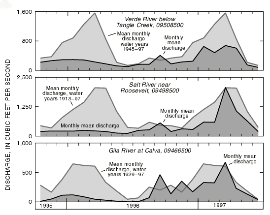
Figure 2. Monthly mean discharge for October 1, 1995, to June 30, 1997, and the mean-monthly discharge for the period of record at Verde River below Tangle Creek, Salt River near Roosevelt, and Gila River at Calva (data for 1997 are provisional and are subject to revision). |