

|
|
|
|
|
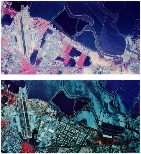
| These images of the extreme South San Francisco Bay are two-color infrared (CIR) aerial photographs taken ten years apart. The photographs have a spatial resolution of 2 to 4 meters. In CIR photographs such as these, vegetation appears in various shades of red and pink, depending mostly on the type and density of the vegetation. CIR photographs taken several years apart can be used to map land-use changes and the distribution of features such as wetlands. Note the changes that have occurred within the wetland areas next to the water as well as the increase in housing and commercial buildings. The photographs can also be used to map the differences in agricultural practices. Photographs like these are digitized and, along with digital satellite images, are used by USGS scientists to examine changes in the water and on land. |
 |