
![]()
![]()
|
USGS Fact Sheet FS-145-99
|
|
| Federal coal resources | |
| It is important for land managers, planners, and
mineral developers to know where the Federal coal is located and how much
Federal coal exists, in order to make informed land-use decisions.
For the seven priority assessment units studied in the Colorado Plateau as part of the National Coal Assessment, we identified Federal and nonfederal surface ownership and coal ownership, and calculated Federal coal resources. The Federal coal resources reported for each assessment unit are less than 6,000 ft deep, except for the Deserado and the Southern Wasatch Plateau units, where the coal resources are less than 2,000 ft deep and less than 4,500 ft deep, respectively. |
|
|
Please click (or double click) unit number for details. 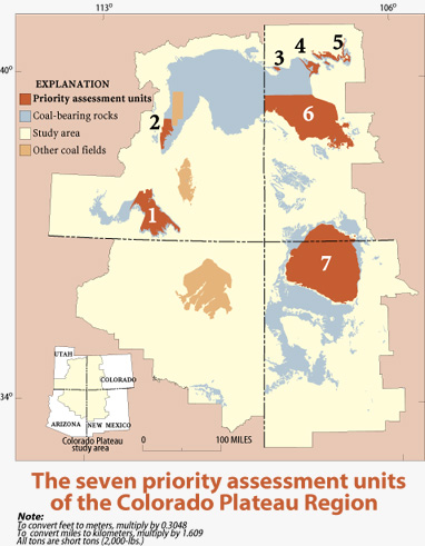
| |
| <<<PREVIOUS | |
|
USGS Fact Sheet FS-145-99
|