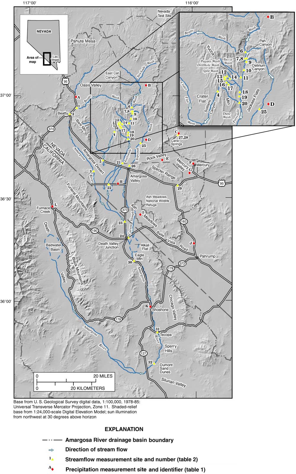
Figure 1. Geographic setting and flow paths of the Amargosa River drainage basin during the February 23-24, 1998, flood.

Fact Sheet 036-01
|
Figure 1. Geographic setting and flow paths of the Amargosa River drainage basin during the February 23-24, 1998, flood. |
 |