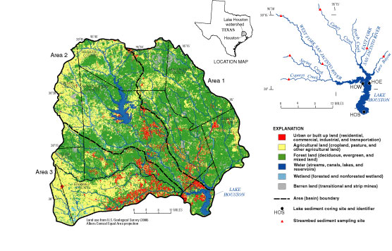
Figure 1. Lake Houston watershed showing land use (about 1992) and locations of lake sediment cores and streambed sediment samples.
Back | Figure 2